|
search place name
|
||
Koungodian (Koulikoro, Mali)Koungodian is a town in the Koulikoro region of Mali. An overview map of the region around Koungodian is displayed below.
regional and 3d topo map of Koungodian, Mali ::

Koungodian airports ::
The nearest airport is BKO - Bamako Senou, located 73.1 km west of Koungodian.
Nearby towns ::
Tyèni (2.0km south) //
Dioumanzana (2.9km west) //
Chyodo (3.7km south west) //
Sokabougou (3.9km north) //
Bouanidiè (4.1km north west) //
Nandjirila (4.2km south east) //
Nanla (4.6km east) //
Moudian (4.9km north west) //
Maribougou (4.9km west) //
Tyèkourabougou (5.0km north east) //
Béninko (5.3km north west) //
Daoudabougou (6.3km north west) //
Ntèga (6.5km north) //
Farako (6.8km south west) //
Sirakoro (7.0km south west) //
Bininko (7.2km north) //
Souleymane Bougou (7.1km east) //
Mouni (7.3km north east) //
Tandougou (7.4km north west) //
Dokala (7.6km south) //
Dirokourani (7.5km west) //
Diro (7.6km west) //
Bakaribougou (7.7km north west) //
Sonkan (7.8km south east) //
Nanla (7.8km east) //
Makadoumbougou (8.1km north) //
Niankorobougou (9.1km south east) //
Bafimbougou (9.3km north east) //
Toukoro (9.4km north east) //
[all distances 'as the bird flies' and approximate] 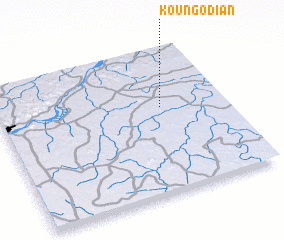 Places with similar names to Koungodian, Mali ::
// Canagatan (PH)
// Canoctan (PH)
// Guinacutan (PH)
// Kangtunao (PH)
// Kinagatan (PH)
// Kinagatan (PH)
// Kinoguitan (PH)
// Kingtown (US)
// Kingtown (US)
// Kingtown (US)
Disclaimer :: Information on this page comes without warranty of any kind |
||
|
Where is Koungodian? Elevation and coordinates ::
Latitude (lat): 12°35'36"N Longitude (lon): 7°16'48"W
Elevation (approx.): 350m (map arrows pan, magnifying glasses zoom) |
||
|
Visiting Koungodian? Hotel/Accommodation ::
Book a hotel in Koungodian Travel Guide ::
Buy a travel guide for Mali rental cars ::
car rental offers GPS waypoint ::
download a GPX waypoint (PoI) of Koungodian for your GPS receiver
|
||