|
search place name
|
||
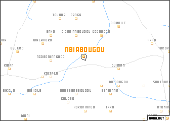
Nbiabougou (Mali)Nbiabougou is a town in Mali. An overview map of the region around Nbiabougou is displayed below.
regional and 3d topo map of Nbiabougou, Mali ::
Nbiabougou airports ::
The nearest airport is BKO - Bamako Senou, located 143.3 km south west of Nbiabougou.
Nearby towns ::
Dionninnbougou (5.8km north) //
Siranvoga (6.6km south east) //
Dodougou (6.6km north east) //
Ngabaninnkoro (7.2km west) //
Guessérébougou (7.6km south) //
Guinian (7.4km east) //
Koïtala (8.1km south west) //
Serimana (9.2km south east) //
Diédougou (9.1km south east) //
Bako (9.1km north west) //
Diombilé (10.3km north east) //
[all distances 'as the bird flies' and approximate] 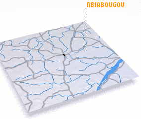 Places with similar names to Nbiabougou, Mali ::
// Nabibougou (BF)
// Nababougou (ML)
// Nababougou (ML)
// Nababougou (ML)
// Nbébougou (ML)
// Nbébougou (ML)
// Nbébougou (ML)
// Nbiabougou (ML)
// Nbiébougou (ML)
// Nbobougou (ML)
Disclaimer :: Information on this page comes without warranty of any kind |
||
|
Where is Nbiabougou? Elevation and coordinates ::
Latitude (lat): 13°36'0"N Longitude (lon): 7°12'0"W
Elevation (approx.): 355m (map arrows pan, magnifying glasses zoom) |
||
|
Visiting Nbiabougou? Hotel/Accommodation ::
Book a hotel in Nbiabougou Travel Guide ::
Buy a travel guide for Mali rental cars ::
car rental offers GPS waypoint ::
download a GPX waypoint (PoI) of Nbiabougou for your GPS receiver
|
||