|
search place name
|
||
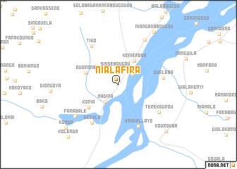
Nialafira (Koulikoro, Mali)Nialafira is a town in the Koulikoro region of Mali. An overview map of the region around Nialafira is displayed below.
regional and 3d topo map of Nialafira, Mali ::
Nialafira airports ::
The nearest airport is BKO - Bamako Senou, located 66.8 km north east of Nialafira.
Nearby towns ::
Sissébougou (2.4km north) //
Bankassi (2.8km north east) //
Madina (3.4km south west) //
Kéniéroba (4.5km north east) //
Ouorona (5.4km west) //
Koria (5.9km south west) //
Guéléba (7.0km east) //
Hamdallaye (7.3km south east) //
Dégala (7.4km south west) //
Tiko (7.4km north west) //
Térékourou (7.6km south east) //
Sambara (8.2km north east) //
Farabalé (8.4km south west) //
Nianganabougou (10.0km north east) //
Kourouba (10.5km south east) //
Kondo (10.7km south west) //
Kolènda (11.4km south west) //
[all distances 'as the bird flies' and approximate]  Places with similar names to Nialafira, Mali ::
// Néa Liverá (GR)
// Naelavere (EE)
// Nilüfer (TR)
// Nalghair (BD)
// Nilivaara (SE)
// Nuolivaara (FI)
Disclaimer :: Information on this page comes without warranty of any kind |
||
|
Where is Nialafira? Elevation and coordinates ::
Latitude (lat): 12°4'49"N Longitude (lon): 8°21'20"W
Elevation (approx.): 339m (map arrows pan, magnifying glasses zoom) |
||
|
Visiting Nialafira? Hotel/Accommodation ::
Book a hotel in Nialafira Travel Guide ::
Buy a travel guide for Mali rental cars ::
car rental offers GPS waypoint ::
download a GPX waypoint (PoI) of Nialafira for your GPS receiver
|
||