|
search place name
|
||
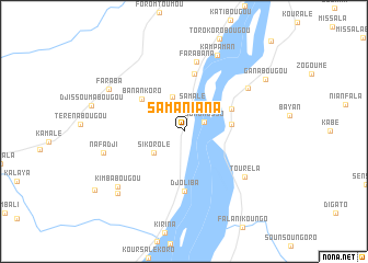
Samaniana (Koulikoro, Mali)Samaniana is a town in the Koulikoro region of Mali. An overview map of the region around Samaniana is displayed below.
regional and 3d topo map of Samaniana, Mali ::
Samaniana airports ::
The nearest airport is BKO - Bamako Senou, located 24.9 km north east of Samaniana.
Nearby towns ::
Somonosso (2.3km north east) //
Samalé (2.8km north) //
Balandougou (3.7km north) //
Sikorolé (3.8km south west) //
Siéné (4.8km east) //
Banko Koura (5.2km north east) //
Banankoro (5.3km north west) //
Soribougou (5.9km north) //
Djoliba (6.1km south) //
Farabana (7.2km north) //
Touréla (7.6km south east) //
Niéniébougou (7.7km north east) //
Kampaman (8.4km north east) //
Nafadji (8.4km west) //
Faraba (8.6km north west) //
Kimbabougou (8.7km south west) //
Balafimbougou (9.1km south west) //
Ganabougou (9.7km north east) //
[all distances 'as the bird flies' and approximate] 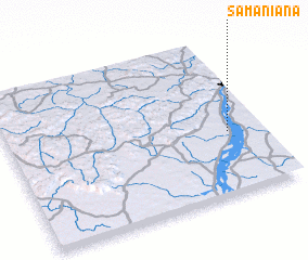 Places with similar names to Samaniana, Mali ::
Disclaimer :: Information on this page comes without warranty of any kind |
||
|
Where is Samaniana? Elevation and coordinates ::
Latitude (lat): 12°23'57"N Longitude (lon): 8°8'1"W
Elevation (approx.): 337m (map arrows pan, magnifying glasses zoom) |
||
|
Visiting Samaniana? Hotel/Accommodation ::
Book a hotel in Samaniana Travel Guide ::
Buy a travel guide for Mali rental cars ::
car rental offers GPS waypoint ::
download a GPX waypoint (PoI) of Samaniana for your GPS receiver
|
||