|
search place name
|
||
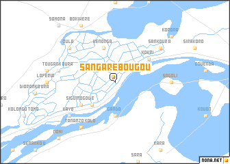
Sangarébougou (Mali)Sangarébougou is a town in Mali. An overview map of the region around Sangarébougou is displayed below.
regional and 3d topo map of Sangarébougou, Mali ::
Sangarébougou airports ::
The nearest airport is MZI - Mopti Ambodedjo, located 171.2 km east of Sangarébougou.
Nearby towns ::
Ouahigouya (5.2km south west) //
Gando (5.6km south) //
Kénonga (5.8km north) //
Siguinogoué (6.5km south west) //
Kokri (6.5km north east) //
Tanan Zokolo (9.2km south west) //
Kayo (9.1km south west) //
Sankoura (9.1km north east) //
Oula (9.1km north west) //
[all distances 'as the bird flies' and approximate]  Places with similar names to Sangarébougou, Mali ::
// Sunkarbek (RU)
// Soungaribougou (BF)
// Sangarébougou (ML)
// Sangarébougou (ML)
// Sangarébougou (ML)
// Sankourabougou (ML)
// Zangorabougou (ML)
Disclaimer :: Information on this page comes without warranty of any kind |
||
|
Where is Sangarébougou? Elevation and coordinates ::
Latitude (lat): 13°56'0"N Longitude (lon): 5°33'0"W
Elevation (approx.): 280m (map arrows pan, magnifying glasses zoom) |
||
|
Visiting Sangarébougou? Hotel/Accommodation ::
Book a hotel in Sangarébougou Travel Guide ::
Buy a travel guide for Mali rental cars ::
car rental offers GPS waypoint ::
download a GPX waypoint (PoI) of Sangarébougou for your GPS receiver
|
||