|
search place name
|
||
Sonityèni (Koulikoro, Mali)Sonityèni is a town in the Koulikoro region of Mali. An overview map of the region around Sonityèni is displayed below.
regional and 3d topo map of Sonityèni, Mali ::

Sonityèni airports ::
The nearest airport is BKO - Bamako Senou, located 41.8 km south of Sonityèni.
Nearby towns ::
Dianéguébougou Safo (2.2km east) //
Kabaro (2.8km south west) //
Fabougoula (3.6km north) //
Bémasso (3.7km west) //
Ngorongodji (3.8km south east) //
Fanafié Koura (3.9km south) //
Noumoubougou (5.2km north east) //
Dotyèna (5.3km east) //
Banankoro (5.6km south west) //
Diélibougou (6.7km south east) //
Darat (6.9km south) //
Tilékoumani (6.8km east) //
Zambougou Koura (6.9km east) //
Salo (7.1km north east) //
Siguintambougou (7.2km south) //
Sikorobougou (7.1km south east) //
Sokolombougou (7.0km west) //
Noumambougou (7.2km south east) //
Fabougoula (7.6km north) //
Ntyènéguébougou (7.9km south) //
Djinidiéla (7.8km north west) //
Fansira Koro (8.0km north) //
Fanafiè Koro (8.1km south west) //
Kababougou (8.1km west) //
Dianéguébougou Diago (8.7km west) //
Fansira Diérobougou (9.7km north west) //
Ouolokoro (10.1km south west) //
Diago Koro (11.4km south west) //
[all distances 'as the bird flies' and approximate] 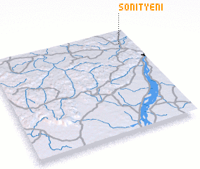 Places with similar names to Sonityèni, Mali ::
// Sindiyūn (EG)
// Sindiyūn (EG)
// Santayana (ES)
// Sindiyānah (SY)
// Sountyana (ML)
// Saint-Oyen (FR)
// Saint-Yan (FR)
// Saint-Yon (FR)
// Saint-Oyen (IT)
Disclaimer :: Information on this page comes without warranty of any kind |
||
|
Where is Sonityèni? Elevation and coordinates ::
Latitude (lat): 12°53'22"N Longitude (lon): 8°4'42"W
Elevation (approx.): 370m (map arrows pan, magnifying glasses zoom) |
||
|
Visiting Sonityèni? Hotel/Accommodation ::
Book a hotel in Sonityèni Travel Guide ::
Buy a travel guide for Mali rental cars ::
car rental offers GPS waypoint ::
download a GPX waypoint (PoI) of Sonityèni for your GPS receiver
|
||