|
search place name
|
||
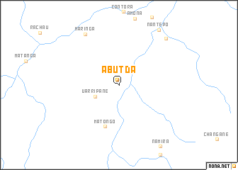
Abutda (Cabo Delgado, Mozambique)Abutda is a town in the Cabo Delgado region of Mozambique. An overview map of the region around Abutda is displayed below.
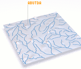
regional and 3d topo map of Abutda, Mozambique ::
Abutda airports ::
The nearest airport is MZB - Mocimboa Da Praia, located 281.5 km north east of Abutda.
Nearby towns ::
 Places with similar names to Abutda, Mozambique ::
// Abetito (IT)
// Abdet (ES)
// Āb Bād-e Do (IR)
// Abdata (TD)
// Abā ad Dūd (SA)
// Abdida (UZ)
// Abdou Dao (SN)
// Abdītā (SY)
// Abatete (NG)
// Abdata (MZ)
Disclaimer :: Information on this page comes without warranty of any kind |
||
|
Where is Abutda? Elevation and coordinates ::
Latitude (lat): 13°3'59"S Longitude (lon): 38°26'1"E
Elevation (approx.): 422m (map arrows pan, magnifying glasses zoom) |
||
|
Visiting Abutda? Hotel/Accommodation ::
Book a hotel in Abutda Travel Guide ::
Buy a travel guide for Mozambique rental cars ::
car rental offers GPS waypoint ::
download a GPX waypoint (PoI) of Abutda for your GPS receiver
|
||