|
search place name
|
||
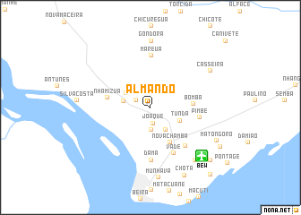
Almando (Sofala, Mozambique)Almando is a town in the Sofala region of Mozambique. An overview map of the region around Almando is displayed below.
regional and 3d topo map of Almando, Mozambique ::
Almando airports ::
The nearest airport is BEW - Beira, located 8.6 km south east of Almando.
Nearby towns ::
Mandoga (1.9km north west) //
Chimbudo (1.9km north west) //
Joaque (2.0km south) //
Meno (2.8km south) //
Chamba (3.2km west) //
Vila Messano (3.4km south east) //
Jungo (3.3km north west) //
Tunda (3.8km south east) //
Nova Chamba (5.0km south east) //
Bomba (5.0km east) //
Nhamizua (5.2km west) //
Pimbe (5.9km east) //
Vade (6.3km south east) //
Mareua (6.4km north) //
Báteo (6.3km south east) //
Dama (6.5km south) //
Gondora (8.3km north) //
Lacticīnia (8.4km south east) //
Casseira (8.4km north east) //
Munhava (8.8km south) //
Matongoro (8.9km south east) //
Chota (9.4km south east) //
António Gamba (9.6km south east) //
Marrucanhe (9.6km south east) //
Luís (11.0km south east) //
[all distances 'as the bird flies' and approximate] 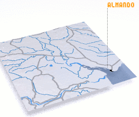 Places with similar names to Almando, Mozambique ::
Disclaimer :: Information on this page comes without warranty of any kind |
||
|
Where is Almando? Elevation and coordinates ::
Latitude (lat): 19°44'28"S Longitude (lon): 34°50'58"E
Elevation (approx.): 23m (map arrows pan, magnifying glasses zoom) |
||
|
Visiting Almando? Hotel/Accommodation ::
Book a hotel in Almando Travel Guide ::
Buy a travel guide for Mozambique rental cars ::
car rental offers GPS waypoint ::
download a GPX waypoint (PoI) of Almando for your GPS receiver
|
||