|
search place name
|
||
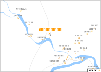
Bara-Aripari (Sofala, Mozambique)Bara-Aripari is a town in the Sofala region of Mozambique. An overview map of the region around Bara-Aripari is displayed below.
regional and 3d topo map of Bara-Aripari, Mozambique ::
Bara-Aripari airports ::
The nearest airport is BEW - Beira, located 105.2 km east of Bara-Aripari.
Nearby towns ::
Matreque (0.8km south) //
Passopa (2.3km south west) //
Parcinga (3.2km south west) //
Fernando (6.5km south east) //
Binda (6.7km south east) //
Guncha (6.9km west) //
Mequisse (7.5km west) //
Manuel (8.4km south east) //
Muguonde (8.7km south) //
Cuzizua (8.6km north west) //
Mabanja (9.5km south east) //
Madara (9.9km south east) //
Veremo (10.3km south east) //
Massequenha (11.5km south east) //
[all distances 'as the bird flies' and approximate] 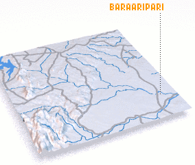
Disclaimer :: Information on this page comes without warranty of any kind |
||
|
Where is Bara-Aripari? Elevation and coordinates ::
Latitude (lat): 19°45'35"S Longitude (lon): 33°54'17"E
Elevation (approx.): 53m (map arrows pan, magnifying glasses zoom) |
||
|
Visiting Bara-Aripari? Hotel/Accommodation ::
Book a hotel in Bara-Aripari Travel Guide ::
Buy a travel guide for Mozambique rental cars ::
car rental offers GPS waypoint ::
download a GPX waypoint (PoI) of Bara-Aripari for your GPS receiver
|
||