|
search place name
|
||
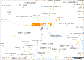
Cabo Matine (Inhambane, Mozambique)Cabo Matine is a town in the Inhambane region of Mozambique. An overview map of the region around Cabo Matine is displayed below.
regional and 3d topo map of Cabo Matine, Mozambique ::
Cabo Matine airports ::
The nearest airport is INH - Inhambane, located 33.7 km south east of Cabo Matine.
Other airports nearby include VNX - Vilankulu Vilankulo (183.6 km north), Nearby towns ::
Mocoduene (1.4km north) //
Cabo Dimande (1.9km south) //
Magueza (2.0km south west) //
Cabo Chiacho (2.5km east) //
Régulo M. Inguana (4.7km north) //
Chemangane (4.9km north west) //
Ingónhama (5.7km south) //
Usseno (5.9km north) //
Cabo Maueua (6.6km south) //
Inguani (6.9km south) //
Induna Chicunja (6.4km west) //
Cabo Chimangane (6.6km west) //
Cabo Dindane (6.7km south east) //
Cabo Bembeluane (7.1km north east) //
Matacalane (7.4km south) //
Cabo Maimela (7.3km north east) //
Cabo Massasse (7.2km west) //
Cabo Malate (8.9km south) //
Cambine (8.5km north east) //
Cabo M. Murrongue (8.8km north west) //
Séfane (8.9km south west) //
Cabo Séfane (9.3km south west) //
Benguane (9.7km south west) //
[all distances 'as the bird flies' and approximate] 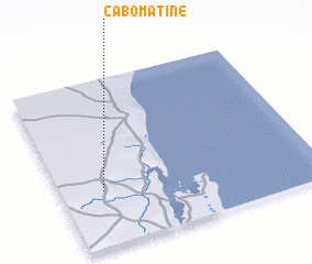 Places with similar names to Cabo Matine, Mozambique ::
// Kabomdan (PG)
Disclaimer :: Information on this page comes without warranty of any kind |
||
|
Where is Cabo Matine? Elevation and coordinates ::
Latitude (lat): 23°40'13"S Longitude (lon): 35°9'54"E
Elevation (approx.): 144m (map arrows pan, magnifying glasses zoom) |
||
|
Visiting Cabo Matine? Hotel/Accommodation ::
Book a hotel in Cabo Matine Travel Guide ::
Buy a travel guide for Mozambique rental cars ::
car rental offers GPS waypoint ::
download a GPX waypoint (PoI) of Cabo Matine for your GPS receiver
|
||