|
search place name
|
||
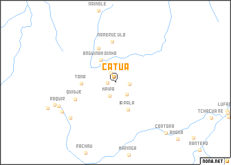
Catua (Cabo Delgado, Mozambique)Catua is a town in the Cabo Delgado region of Mozambique. An overview map of the region around Catua is displayed below.
regional and 3d topo map of Catua, Mozambique ::
Catua airports ::
The nearest airport is MZB - Mocimboa Da Praia, located 274.6 km north east of Catua.
Nearby towns ::
Chipempe (1.2km west) //
Nochaite (1.7km north west) //
Cantehali (2.3km east) //
MʼPipa (2.4km south west) //
Naquequene (2.7km south east) //
Anquiméria (3.0km north west) //
Anguinamoinha (4.3km north west) //
Iapala (4.8km south east) //
Toma (5.4km west) //
Tentevane (6.1km north west) //
Naneruculo (6.7km north) //
Quidje (6.9km south west) //
Namirampa (9.2km south west) //
Uerrimpe (9.6km south west) //
Contôra (11.5km south east) //
[all distances 'as the bird flies' and approximate]  Places with similar names to Catua, Mozambique ::
Disclaimer :: Information on this page comes without warranty of any kind |
||
|
Where is Catua? Elevation and coordinates ::
Latitude (lat): 12°53'20"S Longitude (lon): 38°21'57"E
Elevation (approx.): 477m (map arrows pan, magnifying glasses zoom) |
||
|
Visiting Catua? Hotel/Accommodation ::
Book a hotel in Catua Travel Guide ::
Buy a travel guide for Mozambique rental cars ::
car rental offers GPS waypoint ::
download a GPX waypoint (PoI) of Catua for your GPS receiver
|
||