|
search place name
|
||
Chefe Mutota (Inhambane, Mozambique)Chefe Mutota is a town in the Inhambane region of Mozambique. An overview map of the region around Chefe Mutota is displayed below.
regional and 3d topo map of Chefe Mutota, Mozambique ::

Chefe Mutota airports ::
The nearest airport is INH - Inhambane, located 137.0 km north east of Chefe Mutota.
Other airports nearby include MPM - Maputo (231.8 km south west), Nearby towns ::
Saguate (1.6km south west) //
E. Murende (2.8km north) //
Chibembe (5.1km east) //
Chefe Chitondo (5.4km west) //
Chefe Chibembe (5.5km east) //
Gumbe (6.1km north) //
G. Mubai (6.3km north) //
Chefe Baulane (6.4km north east) //
Mahupe (6.4km west) //
Regedor Canda (7.3km west) //
Chefe Gune (7.3km west) //
Meque Mhavane (8.4km north east) //
G. Nhanenge (9.0km north) //
P. Naete (8.7km north west) //
G. Nhalicale (10.5km north east) //
[all distances 'as the bird flies' and approximate] 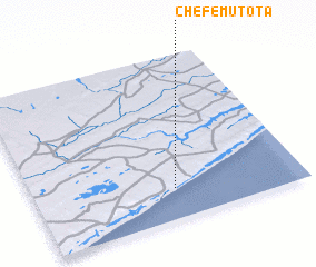 Places with similar names to Chefe Mutota, Mozambique ::
// Chefe Madoda (MZ)
// Chefe Matuta (MZ)
Disclaimer :: Information on this page comes without warranty of any kind |
||
|
Where is Chefe Mutota? Elevation and coordinates ::
Latitude (lat): 24°48'44"S Longitude (lon): 34°31'34"E
Elevation (approx.): 64m (map arrows pan, magnifying glasses zoom) |
||
|
Visiting Chefe Mutota? Hotel/Accommodation ::
Book a hotel in Chefe Mutota Travel Guide ::
Buy a travel guide for Mozambique rental cars ::
car rental offers GPS waypoint ::
download a GPX waypoint (PoI) of Chefe Mutota for your GPS receiver
|
||