|
search place name
|
||
Chefe Nicano (Cabo Delgado, Mozambique)Chefe Nicano is a town in the Cabo Delgado region of Mozambique. An overview map of the region around Chefe Nicano is displayed below.
regional and 3d topo map of Chefe Nicano, Mozambique ::

Chefe Nicano airports ::
The nearest airport is APL - Nampula, located 144.6 km south of Chefe Nicano.
Other airports nearby include POL - Pemba (152.6 km north east), MNC - Nacala (162.0 km south east), Nearby towns ::
Chefe Arrire (2.5km south east) //
Cabo Menepa (3.3km east) //
Nepa (5.2km south east) //
Chefe Cheade (5.3km south west) //
Chefe Nafás (5.6km east) //
Cabo Chimobo (6.0km south west) //
Chefe Rumia (5.9km west) //
Chefe Namuécuè (6.5km north west) //
Régulo Mecufia (7.2km west) //
Humo Nampuatua (7.6km north) //
Chefe Pilale (9.5km south west) //
Namuico (10.7km north east) //
Chefe Muapatcha (11.6km south east) //
[all distances 'as the bird flies' and approximate] 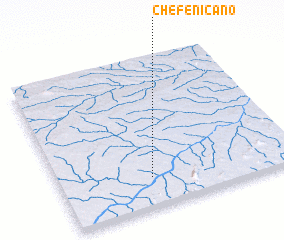 Places with similar names to Chefe Nicano, Mozambique ::
// Chief Nkana (ZM)
// Shevengan (IR)
// Chavanguane (MZ)
// Chavanguane (MZ)
// Chefe Incona (MZ)
// Chefe Nacuna (MZ)
// Chefe Unguana (MZ)
// Chivingoane (MZ)
// Chivonguine (MZ)
// Chivonguine (MZ)
Disclaimer :: Information on this page comes without warranty of any kind |
||
|
Where is Chefe Nicano? Elevation and coordinates ::
Latitude (lat): 13°48'9"S Longitude (lon): 39°23'12"E
Elevation (approx.): 290m (map arrows pan, magnifying glasses zoom) |
||
|
Visiting Chefe Nicano? Hotel/Accommodation ::
Book a hotel in Chefe Nicano Travel Guide ::
Buy a travel guide for Mozambique rental cars ::
car rental offers GPS waypoint ::
download a GPX waypoint (PoI) of Chefe Nicano for your GPS receiver
|
||