|
search place name
|
||
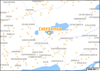
Chefe Pindo (Inhambane, Mozambique)Chefe Pindo is a town in the Inhambane region of Mozambique. An overview map of the region around Chefe Pindo is displayed below.
regional and 3d topo map of Chefe Pindo, Mozambique ::
Chefe Pindo airports ::
The nearest airport is INH - Inhambane, located 71.2 km north east of Chefe Pindo.
Nearby towns ::
Fequene (0.6km south west) //
Cat. Congregacional (1.4km south east) //
Cat. Congregacional (3.1km east) //
Nhaúaque (3.6km south east) //
Chefe Banzala (4.3km east) //
Chefe Chichocolomo (5.0km south) //
Cat. Feiticista (4.9km south west) //
Cat. Luz Africana (5.1km south east) //
Ussaque (5.6km south west) //
Amone Bie (5.9km south) //
Chefe Chamba (5.6km west) //
Chicuine (5.7km south east) //
Laite (5.6km east) //
Nhaussicate (5.9km east) //
Cabo Macupulana (6.2km south east) //
Chefe Nhazunde (6.6km south east) //
Chefe Bie (6.9km south) //
Cabo Mavunjane (6.3km west) //
Chefe Canda (6.9km south) //
Chefe Matsope (7.3km west) //
Chefe Chigohi (7.9km south) //
Chefe Maesse (7.4km east) //
Cabo Nhatumbo (7.9km south east) //
Rui Gole (7.5km west) //
Chefe Massivequele (7.6km east) //
M. Nhabombe (7.9km south west) //
Chefe Chiongo (7.7km west) //
António Silva (8.4km north) //
Chefe Ocule (8.5km south) //
[all distances 'as the bird flies' and approximate]  Places with similar names to Chefe Pindo, Mozambique ::
Disclaimer :: Information on this page comes without warranty of any kind |
||
|
Where is Chefe Pindo? Elevation and coordinates ::
Latitude (lat): 24°22'45"S Longitude (lon): 34°58'19"E
Elevation (approx.): 99m (map arrows pan, magnifying glasses zoom) |
||
|
Visiting Chefe Pindo? Hotel/Accommodation ::
Book a hotel in Chefe Pindo Travel Guide ::
Buy a travel guide for Mozambique rental cars ::
car rental offers GPS waypoint ::
download a GPX waypoint (PoI) of Chefe Pindo for your GPS receiver
|
||