|
search place name
|
||
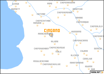
Cingano (Niassa, Mozambique)Cingano is a town in the Niassa region of Mozambique. An overview map of the region around Cingano is displayed below.
regional and 3d topo map of Cingano, Mozambique ::
Cingano airports ::
The nearest airport is BLZ - Blantyre Chileka Intl, located 108.1 km west of Cingano.
Nearby towns ::
Chefe Nangune (2.4km north west) //
Milione (2.6km south) //
Panachêngua (2.6km west) //
Chefe Cagingué (5.1km south) //
Chefe Chitimbe (5.8km north west) //
Chefe Urandule (6.0km south) //
Chefe Muember (6.3km south west) //
Chefe Vatiua (6.4km east) //
Têblê (6.6km south) //
Namuaia (6.6km north west) //
Bendela (7.0km south west) //
Chefe Nambande (7.4km north) //
Chitimbe (8.3km north west) //
Mussórro (8.5km east) //
Chefe Mepemba (9.1km north east) //
Mlàviúa (9.0km east) //
Chefe Nacuna (10.5km north west) //
Alicaca (10.9km south east) //
[all distances 'as the bird flies' and approximate] 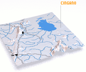 Places with similar names to Cingano, Mozambique ::
Disclaimer :: Information on this page comes without warranty of any kind |
||
|
Where is Cingano? Elevation and coordinates ::
Latitude (lat): 15°23'0"S Longitude (lon): 35°56'3"E
Elevation (approx.): 669m (map arrows pan, magnifying glasses zoom) |
||
|
Visiting Cingano? Hotel/Accommodation ::
Book a hotel in Cingano Travel Guide ::
Buy a travel guide for Mozambique rental cars ::
car rental offers GPS waypoint ::
download a GPX waypoint (PoI) of Cingano for your GPS receiver
|
||