|
search place name
|
||
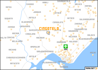
Cingatela (Maputo, Mozambique)Cingatela is a town in the Maputo region of Mozambique. An overview map of the region around Cingatela is displayed below.
regional and 3d topo map of Cingatela, Mozambique ::
Cingatela airports ::
The nearest airport is MPM - Maputo, located 7.3 km south east of Cingatela.
Other airports nearby include SZK - Skukuza (138.1 km north west), MTS - Manzini Matsapha (140.5 km south west), HDS - Hoedspruit Afb (223.5 km north west), PHW - Phalaborwa (255.4 km north west), Nearby towns ::
São Damaso (1.1km east) //
Bairro Patricio Lumumba (1.5km south) //
Domingos (1.6km south west) //
Macacamela (1.8km east) //
Maíssa (2.1km south) //
Nhocuane (3.2km north east) //
Javeta (3.1km east) //
Machava (3.5km south west) //
S. Vincente de Paulo (3.9km west) //
Bairro Vinte e Cinco de Junho "A" (4.6km south east) //
Bagamoyo (4.7km east) //
Congolote (5.0km north east) //
Jardim (5.2km south east) //
Santa Maria (5.1km north east) //
Inhagoia "B" (5.3km south east) //
Benfica (5.3km east) //
Amadora (5.3km east) //
Inhagoia "A" (5.6km south east) //
Filipe (6.1km north) //
Zimpeto (5.6km east) //
São João de Deus (5.7km north east) //
Bairro George Dimitrov (5.9km east) //
Luís Cabral (6.9km south) //
C. Magilane (6.4km west) //
Bairro Vinte e Cinco de Junho "B" (6.6km east) //
São José Operário (7.3km south) //
Chamanculo "C" (7.2km south east) //
Unidade Sete (7.1km south east) //
Cipamane (7.5km north) //
[all distances 'as the bird flies' and approximate] 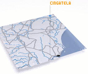 Places with similar names to Cingatela, Mozambique ::
// Singut Alè (MM)
// Sangatile (CD)
// Sangatile (CD)
// Sunkatal (IN)
// Zaina Kadal (IN)
// Sancadilla (VE)
// Zancudal (VE)
// Sangdaeil-li (KP)
// Sangdal-li (KP)
// Sangdal-li (KP)
Disclaimer :: Information on this page comes without warranty of any kind |
||
|
Where is Cingatela? Elevation and coordinates ::
Latitude (lat): 25°52'51"S Longitude (lon): 32°30'55"E
Elevation (approx.): 39m (map arrows pan, magnifying glasses zoom) |
||
|
Visiting Cingatela? Hotel/Accommodation ::
Book a hotel in Cingatela Travel Guide ::
Buy a travel guide for Mozambique rental cars ::
car rental offers GPS waypoint ::
download a GPX waypoint (PoI) of Cingatela for your GPS receiver
|
||