|
search place name
|
||
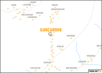
Guacuanhe (Sofala, Mozambique)Guacuanhe is a town in the Sofala region of Mozambique. An overview map of the region around Guacuanhe is displayed below.
regional and 3d topo map of Guacuanhe, Mozambique ::
Guacuanhe airports ::
The nearest airport is BEW - Beira, located 87.9 km north east of Guacuanhe.
Other airports nearby include VNX - Vilankulu Vilankulo (240.6 km south east), Nearby towns ::
Mupino (0.7km north east) //
Magoda (1.1km south east) //
Soiana (1.2km north) //
Magoco (1.8km north east) //
Chiganiço (2.0km south) //
Padabamuè (2.0km north) //
Uaene (2.5km north east) //
Murabuesse (3.3km south) //
Velocanhe (4.0km south) //
Chambira (4.8km south) //
Zimucacaça (5.1km north) //
Chiguaro (5.3km south) //
Vassoura (5.4km north) //
Aideja (5.5km south east) //
Jibamo (5.9km north) //
Mataque (6.0km south) //
Changuma (6.3km south east) //
Chendemeconhe (6.5km north) //
Majande (6.7km south) //
Bovana (6.9km north) //
Mozonde (7.3km north) //
Maponde (6.9km east) //
Chissinguana (7.4km south) //
Machama (8.1km north) //
Pangamaio (8.5km south) //
Najiji (8.5km north) //
Marera (8.8km north west) //
Datiana (9.0km north) //
Maporga (8.8km north west) //
[all distances 'as the bird flies' and approximate]  Places with similar names to Guacuanhe, Mozambique ::
Disclaimer :: Information on this page comes without warranty of any kind |
||
|
Where is Guacuanhe? Elevation and coordinates ::
Latitude (lat): 20°8'22"S Longitude (lon): 34°8'59"E
Elevation (approx.): 151m (map arrows pan, magnifying glasses zoom) |
||
|
Visiting Guacuanhe? Hotel/Accommodation ::
Book a hotel in Guacuanhe Travel Guide ::
Buy a travel guide for Mozambique rental cars ::
car rental offers GPS waypoint ::
download a GPX waypoint (PoI) of Guacuanhe for your GPS receiver
|
||