|
search place name
|
||
Levene (Inhambane, Mozambique)Levene is a town in the Inhambane region of Mozambique. An overview map of the region around Levene is displayed below.
regional and 3d topo map of Levene, Mozambique ::

Levene airports ::
The nearest airport is INH - Inhambane, located 26.7 km north east of Levene.
Nearby towns ::
Joane Levene (0.0km north) //
Lucas Macassa (0.5km north east) //
Joane Levene (0.6km north east) //
Chefe Dauca (1.1km east) //
Cabo Uputo (2.5km north east) //
Cat. Anglicana (2.7km north west) //
Chefe Mafacaviana (2.9km south east) //
Natingue (3.1km north east) //
Domingos (3.4km north west) //
Conceição (3.7km south) //
Chefe Garramo (3.8km north west) //
Alvaro Pene (3.9km north) //
Uachi (4.1km west) //
Magoane (4.7km north east) //
Galo (5.1km north) //
Nova Trancoso (5.2km north east) //
Nova Milreu (5.1km west) //
Regedor Bogacha (5.3km south west) //
Régulo Mocumba (5.7km north) //
Tene (5.8km east) //
São Francisco de Assis (6.0km east) //
Naene (6.0km east) //
Chefe Jamo (6.4km south west) //
Z. Muchange (6.2km east) //
Bauhoffer (6.3km south east) //
Chefe Muachiculo (6.3km west) //
Netico Nhalombe (6.6km south east) //
Bandeira (7.3km south) //
Chefe Matenga (6.7km east) //
[all distances 'as the bird flies' and approximate] 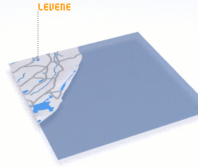 Places with similar names to Levene, Mozambique ::
Disclaimer :: Information on this page comes without warranty of any kind |
||
|
Where is Levene? Elevation and coordinates ::
Latitude (lat): 24°2'16"S Longitude (lon): 35°12'51"E
Elevation (approx.): 70m (map arrows pan, magnifying glasses zoom) |
||
|
Visiting Levene? Hotel/Accommodation ::
Book a hotel in Levene Travel Guide ::
Buy a travel guide for Mozambique rental cars ::
car rental offers GPS waypoint ::
download a GPX waypoint (PoI) of Levene for your GPS receiver
|
||