|
search place name
|
||
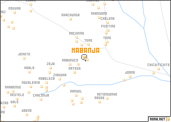
Mabanja (Sofala, Mozambique)Mabanja is a town in the Sofala region of Mozambique. An overview map of the region around Mabanja is displayed below.
regional and 3d topo map of Mabanja, Mozambique ::
Mabanja airports ::
The nearest airport is BEW - Beira, located 143.0 km north east of Mabanja.
Other airports nearby include VNX - Vilankulu Vilankulo (218.2 km south east), Nearby towns ::
Mabungondale (0.5km north east) //
Gomondo (1.2km north) //
Languene (1.7km south west) //
Maburuco (3.2km west) //
Mateus (3.4km south west) //
Maanganhe (3.5km north east) //
Muxungue (3.6km north) //
Muvingue (3.6km north) //
Tepe (3.7km north) //
Chelene (4.7km north west) //
Macurine (5.5km north) //
Inhafenga (5.5km north east) //
Tepe (6.1km north east) //
Ziaduma (6.6km south west) //
Chingondo (6.9km south west) //
Massojo (7.5km north east) //
Manuel (7.8km south) //
Zeja (7.4km west) //
Musindo (8.2km south) //
Madumelane (7.7km west) //
Fivetine (8.2km north east) //
Nhamane (9.1km south) //
Mambe (8.9km south east) //
Metondonhe (9.3km south east) //
Chelene (9.5km north east) //
Mabeleza (9.3km south west) //
Zingane (9.8km south west) //
Nhamessengue (10.3km south west) //
[all distances 'as the bird flies' and approximate] 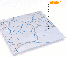 Places with similar names to Mabanja, Mozambique ::
Disclaimer :: Information on this page comes without warranty of any kind |
||
|
Where is Mabanja? Elevation and coordinates ::
Latitude (lat): 20°36'31"S Longitude (lon): 33°50'36"E
Elevation (approx.): 150m (map arrows pan, magnifying glasses zoom) |
||
|
Visiting Mabanja? Hotel/Accommodation ::
Book a hotel in Mabanja Travel Guide ::
Buy a travel guide for Mozambique rental cars ::
car rental offers GPS waypoint ::
download a GPX waypoint (PoI) of Mabanja for your GPS receiver
|
||