|
search place name
|
||
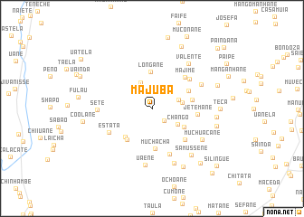
Majuba (Inhambane, Mozambique)Majuba is a town in the Inhambane region of Mozambique. An overview map of the region around Majuba is displayed below.
regional and 3d topo map of Majuba, Mozambique ::
Majuba airports ::
The nearest airport is VNX - Vilankulu Vilankulo, located 105.4 km east of Majuba.
Other airports nearby include BEW - Beira (226.5 km north), Nearby towns ::
Ndjavane (2.0km south east) //
Mundala (3.4km north) //
Milice (3.2km east) //
Chango (3.5km south east) //
Mavecane (3.5km east) //
Longane (4.6km north) //
Suacane (4.4km south east) //
Coane (4.6km south west) //
Ambane (4.6km south west) //
Mesa (4.8km south west) //
Muchacha (5.0km south) //
Cumane (4.7km north east) //
Manhatela (4.8km east) //
Majime (5.4km north east) //
Caolane (5.4km south east) //
Jetemane (5.3km east) //
Chauane (5.6km north east) //
Estata (5.7km south west) //
Chibucane (6.0km south) //
Sete (6.3km west) //
Cabo Chembanda (6.4km north east) //
Uaene (7.0km south) //
Valente (7.0km north east) //
Chefe Chitanga (7.2km south) //
Muchuacane (6.9km south east) //
Samussene (7.3km south east) //
Faife (7.5km east) //
Chechangue (8.0km south east) //
Tiano (7.7km east) //
[all distances 'as the bird flies' and approximate] 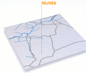 Places with similar names to Majuba, Mozambique ::
Disclaimer :: Information on this page comes without warranty of any kind |
||
|
Where is Majuba? Elevation and coordinates ::
Latitude (lat): 21°46'7"S Longitude (lon): 34°19'46"E
Elevation (approx.): 185m (map arrows pan, magnifying glasses zoom) |
||
|
Visiting Majuba? Hotel/Accommodation ::
Book a hotel in Majuba Travel Guide ::
Buy a travel guide for Mozambique rental cars ::
car rental offers GPS waypoint ::
download a GPX waypoint (PoI) of Majuba for your GPS receiver
|
||