|
search place name
|
||
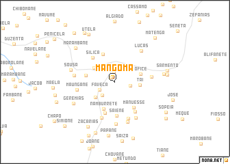
Mangoma (Inhambane, Mozambique)Mangoma is a town in the Inhambane region of Mozambique. An overview map of the region around Mangoma is displayed below.
regional and 3d topo map of Mangoma, Mozambique ::
Mangoma airports ::
The nearest airport is VNX - Vilankulu Vilankulo, located 93.2 km south east of Mangoma.
Other airports nearby include BEW - Beira (194.2 km north), Nearby towns ::
Sevene (0.9km north west) //
Luido (1.5km north) //
Chinguane (2.4km east) //
Faveca (2.6km south west) //
Ofisso (2.9km south west) //
Muchache (3.9km south west) //
Tai (3.8km east) //
Finiche (3.9km north west) //
Ofice (4.1km east) //
Namburrete (4.7km south) //
Naene (4.6km west) //
Samuel (4.9km north) //
Manuesse (5.0km south east) //
Silica (5.2km north west) //
Fanequiço (5.3km south) //
Saiene (5.5km south) //
Fulau (5.8km south east) //
Maguezane (5.6km east) //
Uaene (6.2km south) //
Saisse (6.3km south) //
Maungane (5.9km west) //
Lucas (6.5km north east) //
Laisse (6.6km south east) //
Mazaze (6.3km west) //
Melice (6.8km south) //
Peiane (6.9km south) //
Sousa (6.9km west) //
Geremias (7.2km south west) //
Singarril (7.6km east) //
[all distances 'as the bird flies' and approximate] 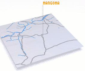 Places with similar names to Mangoma, Mozambique ::
Disclaimer :: Information on this page comes without warranty of any kind |
||
|
Where is Mangoma? Elevation and coordinates ::
Latitude (lat): 21°31'26"S Longitude (lon): 34°35'1"E
Elevation (approx.): 134m (map arrows pan, magnifying glasses zoom) |
||
|
Visiting Mangoma? Hotel/Accommodation ::
Book a hotel in Mangoma Travel Guide ::
Buy a travel guide for Mozambique rental cars ::
car rental offers GPS waypoint ::
download a GPX waypoint (PoI) of Mangoma for your GPS receiver
|
||