|
search place name
|
||
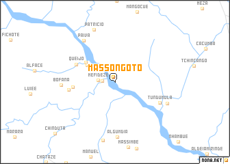
Massongoto (Tete, Mozambique)Massongoto is a town in the Tete region of Mozambique. An overview map of the region around Massongoto is displayed below.
regional and 3d topo map of Massongoto, Mozambique ::
Massongoto airports ::
The nearest airport is TET - Tete Chingodzi, located 43.6 km south east of Massongoto.
Other airports nearby include BLZ - Blantyre Chileka Intl (180.7 km east), Nearby towns ::
Joaquim Filipe (2.0km west) //
Mefideze (2.6km west) //
Catombo (5.1km north west) //
Bete (5.5km north west) //
Queijo (6.7km north west) //
Chabuezeda (6.7km west) //
Chamuarira (7.4km west) //
Tundumula (7.8km south east) //
Paiva (8.3km north west) //
Bofana (8.5km west) //
Patrício (9.1km north) //
Mavuze (9.0km south east) //
[all distances 'as the bird flies' and approximate]  Places with similar names to Massongoto, Mozambique ::
// Masunguti (CD)
// Masinigudi (IN)
// Massinguita (MZ)
// Misnagate (SO)
// Musongati (BI)
// Masinkotaw (SL)
Disclaimer :: Information on this page comes without warranty of any kind |
||
|
Where is Massongoto? Elevation and coordinates ::
Latitude (lat): 15°53'10"S Longitude (lon): 33°18'3"E
Elevation (approx.): 154m (map arrows pan, magnifying glasses zoom) |
||
|
Visiting Massongoto? Hotel/Accommodation ::
Book a hotel in Massongoto Travel Guide ::
Buy a travel guide for Mozambique rental cars ::
car rental offers GPS waypoint ::
download a GPX waypoint (PoI) of Massongoto for your GPS receiver
|
||