|
search place name
|
||
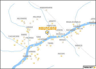
Maungane (Mozambique)Maungane is a town in Mozambique. An overview map of the region around Maungane is displayed below.
regional and 3d topo map of Maungane, Mozambique ::
Maungane airports ::
The nearest airport is VNX - Vilankulu Vilankulo, located 129.2 km south east of Maungane.
Other airports nearby include BEW - Beira (154.0 km north), Nearby towns ::
Coutore (0.8km south) //
Camiau (1.8km east) //
Joaquim Govene (2.2km south east) //
Camuane (2.5km south east) //
Faifetine (2.8km north east) //
Currima (3.3km south west) //
Catechano (3.5km east) //
Tomo (3.9km south west) //
Mufúcua (4.2km south) //
Tomás (4.3km south) //
Pemene (4.2km east) //
Amadeu (4.3km south west) //
Josefa (4.6km north) //
Penicela (4.6km east) //
Maconza (5.1km south west) //
Meque (5.2km south west) //
José (5.8km east) //
Jossai (6.2km south west) //
Manuel (6.1km south east) //
Quissemusse (6.5km south west) //
Chinzavane (6.7km south west) //
Muganjáne (7.1km south west) //
Malonga (7.2km north west) //
Vila Franca do Save (6.9km east) //
Gogóio (7.0km west) //
Falange (7.1km west) //
Manuel (7.2km west) //
Maculuge (7.5km north west) //
Chilile (7.3km west) //
[all distances 'as the bird flies' and approximate] 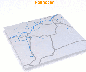 Places with similar names to Maungane, Mozambique ::
Disclaimer :: Information on this page comes without warranty of any kind |
||
|
Where is Maungane? Elevation and coordinates ::
Latitude (lat): 21°8'0"S Longitude (lon): 34°30'0"E
Elevation (approx.): 62m (map arrows pan, magnifying glasses zoom) |
||
|
Visiting Maungane? Hotel/Accommodation ::
Book a hotel in Maungane Travel Guide ::
Buy a travel guide for Mozambique rental cars ::
car rental offers GPS waypoint ::
download a GPX waypoint (PoI) of Maungane for your GPS receiver
|
||