|
search place name
|
||
Muáli (Cabo Delgado, Mozambique)Muáli is a town in the Cabo Delgado region of Mozambique. An overview map of the region around Muáli is displayed below.
regional and 3d topo map of Muáli, Mozambique ::

Muáli airports ::
The nearest airport is APL - Nampula, located 169.8 km south of Muáli.
Other airports nearby include POL - Pemba (191.6 km east), MNC - Nacala (220.1 km south east), Nearby towns ::
Chefe Mohole (1.1km north west) //
Chefe Chivarro (1.5km south east) //
Cassia (1.8km north) //
Nicole (2.3km north west) //
Chefe Niuaua (3.1km south east) //
Chefe Nicua (3.1km south west) //
Namorre (3.3km east) //
Chefe Namarrepa (3.6km north west) //
Merrungo (5.8km north) //
Basílio Seguro (6.3km west) //
Chefe Puépuè (6.7km south) //
Cabo Nʼ Rêpo (6.8km north west) //
Namuno (6.9km west) //
Cabo Uela (7.9km north) //
Namuno (8.1km west) //
Malico (8.5km west) //
Napigale (9.8km south west) //
Namacoma (10.7km north west) //
Cocoma (11.5km south west) //
[all distances 'as the bird flies' and approximate] 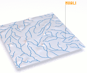 Places with similar names to Muáli, Mozambique ::
Disclaimer :: Information on this page comes without warranty of any kind |
||
|
Where is Muáli? Elevation and coordinates ::
Latitude (lat): 13°37'19"S Longitude (lon): 38°52'40"E
Elevation (approx.): 421m (map arrows pan, magnifying glasses zoom) |
||
|
Visiting Muáli? Hotel/Accommodation ::
Book a hotel in Muáli Travel Guide ::
Buy a travel guide for Mozambique rental cars ::
car rental offers GPS waypoint ::
download a GPX waypoint (PoI) of Muáli for your GPS receiver
|
||