|
search place name
|
||
Muteia (Zambézia, Mozambique)Muteia is a town in the Zambézia region of Mozambique. An overview map of the region around Muteia is displayed below.
regional and 3d topo map of Muteia, Mozambique ::

Muteia airports ::
The nearest airport is UEL - Quelimane, located 99.7 km south west of Muteia.
Nearby towns ::
Moscarra (1.4km north) //
Nandare (2.9km east) //
Manheta (3.1km west) //
Messia (3.1km south west) //
Lemechi (3.7km south east) //
Molage (4.0km south west) //
Matope (4.2km south east) //
Solomondo (4.2km west) //
Tego (4.8km south east) //
Nicucute (4.7km west) //
Fainho (6.2km north west) //
Mafumare (7.2km south west) //
Libra (7.2km south east) //
Canguo (7.2km south east) //
Tendere (7.7km south) //
Salgueiro (8.4km south) //
Batela (8.6km south) //
Marrambuanha (9.1km south) //
[all distances 'as the bird flies' and approximate] 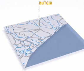 Places with similar names to Muteia, Mozambique ::
Disclaimer :: Information on this page comes without warranty of any kind |
||
|
Where is Muteia? Elevation and coordinates ::
Latitude (lat): 17°13'35"S Longitude (lon): 37°32'27"E
Elevation (approx.): 16m (map arrows pan, magnifying glasses zoom) |
||
|
Visiting Muteia? Hotel/Accommodation ::
Book a hotel in Muteia Travel Guide ::
Buy a travel guide for Mozambique rental cars ::
car rental offers GPS waypoint ::
download a GPX waypoint (PoI) of Muteia for your GPS receiver
|
||