|
search place name
|
||
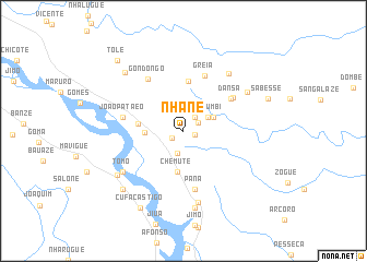
Nhane (Sofala, Mozambique)Nhane is a town in the Sofala region of Mozambique. An overview map of the region around Nhane is displayed below.
regional and 3d topo map of Nhane, Mozambique ::
Nhane airports ::
The nearest airport is UEL - Quelimane, located 107.6 km east of Nhane.
Other airports nearby include BEW - Beira (213.1 km south west), Nearby towns ::
Tomo (1.2km east) //
Chimbazo (1.3km south west) //
Nharugue (1.6km north east) //
Tomo (1.8km north east) //
Genge (2.4km south) //
Chiri (2.8km north east) //
Arujuane (3.2km north east) //
Sandramo (3.2km north east) //
Vumbi (3.2km north east) //
Ventura (3.7km west) //
Chemute (4.2km south) //
Nhandomba (4.5km west) //
Cazene (5.1km north) //
Dansa (5.7km north east) //
Greia (6.0km north) //
Aleixo (6.1km south) //
Pana (6.1km south) //
Binze (6.0km north east) //
João Pataeo (6.1km west) //
Gondongo (6.3km north west) //
Tomo (7.2km south west) //
Luís (7.2km south west) //
Calanhama (7.3km north east) //
Malulo (7.5km south) //
Matanganha (7.3km north east) //
Simone (7.9km south) //
Camacho (7.8km south west) //
Mariano (8.2km north west) //
Dausse (8.4km south west) //
[all distances 'as the bird flies' and approximate] 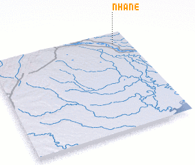 Places with similar names to Nhane, Mozambique ::
Disclaimer :: Information on this page comes without warranty of any kind |
||
|
Where is Nhane? Elevation and coordinates ::
Latitude (lat): 18°6'46"S Longitude (lon): 35°53'21"E
Elevation (approx.): 14m (map arrows pan, magnifying glasses zoom) |
||
|
Visiting Nhane? Hotel/Accommodation ::
Book a hotel in Nhane Travel Guide ::
Buy a travel guide for Mozambique rental cars ::
car rental offers GPS waypoint ::
download a GPX waypoint (PoI) of Nhane for your GPS receiver
|
||