|
search place name
|
||
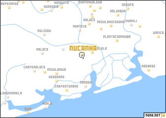
Nucanha (Zambézia, Mozambique)Nucanha is a town in the Zambézia region of Mozambique. An overview map of the region around Nucanha is displayed below.
regional and 3d topo map of Nucanha, Mozambique ::
Nucanha airports ::
The nearest airport is UEL - Quelimane, located 201.1 km south west of Nucanha.
Other airports nearby include APL - Nampula (227.6 km north), Nearby towns ::
Plantacão Melela (2.5km north east) //
Macuete (4.8km north west) //
Namoda (6.3km south) //
Muatexe (6.6km north) //
Régulo Muia (6.5km south west) //
Ussamane (7.5km south west) //
Chefe Neruculo (7.9km north east) //
Chefe Atumane (8.0km south west) //
Malaco (8.1km north) //
Plantacão Nhuba (8.5km north east) //
Murrumuana (8.8km west) //
Régulo Mucodoma (9.6km north east) //
Muligodi (10.0km north west) //
[all distances 'as the bird flies' and approximate] 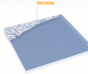 Places with similar names to Nucanha, Mozambique ::
Disclaimer :: Information on this page comes without warranty of any kind |
||
|
Where is Nucanha? Elevation and coordinates ::
Latitude (lat): 17°2'25"S Longitude (lon): 38°33'40"E
Elevation (approx.): 28m (map arrows pan, magnifying glasses zoom) |
||
|
Visiting Nucanha? Hotel/Accommodation ::
Book a hotel in Nucanha Travel Guide ::
Buy a travel guide for Mozambique rental cars ::
car rental offers GPS waypoint ::
download a GPX waypoint (PoI) of Nucanha for your GPS receiver
|
||