|
search place name
|
||
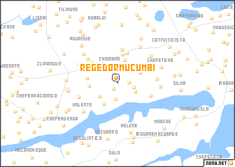
Regedor Mucumbi (Inhambane, Mozambique)Regedor Mucumbi is a town in the Inhambane region of Mozambique. An overview map of the region around Regedor Mucumbi is displayed below.
regional and 3d topo map of Regedor Mucumbi, Mozambique ::
Regedor Mucumbi airports ::
The nearest airport is INH - Inhambane, located 85.5 km north east of Regedor Mucumbi.
Nearby towns ::
Chefe Nhancuahe (1.0km south west) //
Bande Diane (1.8km north) //
Chefe Massite (1.7km east) //
Uaiene (2.5km south) //
Cabo Mangorro (2.5km east) //
Chirramo (3.0km north) //
Chefe Nhachume (2.9km south east) //
Chefe Mengane (3.3km south west) //
Chefe Chalaulene (3.9km north) //
Chefe Nhassico (3.8km south west) //
Chefe Nhaduco (3.7km north east) //
Matubué (4.1km west) //
Julião Muchine (4.7km north) //
Maalamba (4.6km north west) //
J. Zimanhane (4.6km west) //
Chefe Mangite (5.1km north) //
F. Nhateve (5.2km north west) //
Zonequela Bequize (5.5km north) //
Induna Valente (5.2km east) //
Cabo Mahalamba (5.3km north west) //
F. Nomboro (5.9km north west) //
Cabo Chitave (5.8km east) //
Cat. Metodista (6.1km west) //
Maalamba (6.4km north west) //
M. Nhabombe (6.6km north east) //
Chefe Munhicuane (6.8km north east) //
Chissasse (6.3km east) //
Valente (6.7km south west) //
X. Nhangumbe (6.8km north west) //
[all distances 'as the bird flies' and approximate] 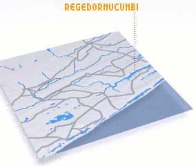 Places with similar names to Regedor Mucumbi, Mozambique ::
// Regedor Muguambe (MZ)
Disclaimer :: Information on this page comes without warranty of any kind |
||
|
Where is Regedor Mucumbi? Elevation and coordinates ::
Latitude (lat): 24°28'2"S Longitude (lon): 34°52'0"E
Elevation (approx.): 74m (map arrows pan, magnifying glasses zoom) |
||
|
Visiting Regedor Mucumbi? Hotel/Accommodation ::
Book a hotel in Regedor Mucumbi Travel Guide ::
Buy a travel guide for Mozambique rental cars ::
car rental offers GPS waypoint ::
download a GPX waypoint (PoI) of Regedor Mucumbi for your GPS receiver
|
||