|
search place name
|
||
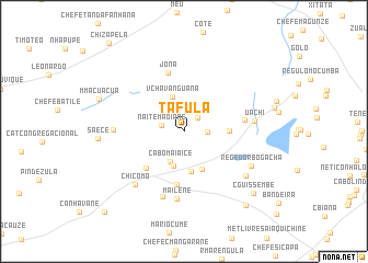
Tafula (Inhambane, Mozambique)Tafula is a town in the Inhambane region of Mozambique. An overview map of the region around Tafula is displayed below.
regional and 3d topo map of Tafula, Mozambique ::
Tafula airports ::
The nearest airport is INH - Inhambane, located 35.0 km north east of Tafula.
Nearby towns ::
Gobe (1.9km north east) //
C.Muachiculo (2.2km east) //
Naíte Maoíane (2.2km west) //
Cabo Maiaice (3.3km south) //
Maaissa (3.6km south) //
V. Chavanguana (3.7km north) //
Nhaxoxo (4.1km south) //
Cabo Nhachocho (4.2km south east) //
Chefe Muachiculo (4.2km east) //
Cabo Mubécua (5.1km south west) //
Met. Livre (5.5km south) //
Jona (6.1km north) //
Nova Milreu (5.7km east) //
Mailene (6.9km south) //
Chefe Mailene (6.9km south) //
Cabo Marrange (6.6km west) //
Uachi (6.7km east) //
Chicomo (7.1km south west) //
Chefe Jamo (7.3km south east) //
Regedor Bogacha (7.2km south east) //
Saece (8.0km west) //
M. Macuácua (8.6km north west) //
C. Guissembe (9.0km south east) //
Guissembe (9.5km south east) //
Cabo Chiambo (11.0km south west) //
[all distances 'as the bird flies' and approximate] 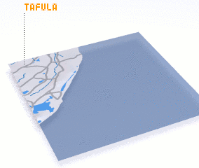 Places with similar names to Tafula, Mozambique ::
Disclaimer :: Information on this page comes without warranty of any kind |
||
|
Where is Tafula? Elevation and coordinates ::
Latitude (lat): 24°2'8"S Longitude (lon): 35°6'40"E
Elevation (approx.): 59m (map arrows pan, magnifying glasses zoom) |
||
|
Visiting Tafula? Hotel/Accommodation ::
Book a hotel in Tafula Travel Guide ::
Buy a travel guide for Mozambique rental cars ::
car rental offers GPS waypoint ::
download a GPX waypoint (PoI) of Tafula for your GPS receiver
|
||