|
search place name
|
||
Kageta (Papua New Guinea)Kageta is a town in Papua New Guinea. An overview map of the region around Kageta is displayed below.
regional and 3d topo map of Kageta, Papua New Guinea ::

Nearby towns ::
Mua (1.9km north) //
Numapo (1.8km west) //
Tairere (1.8km east) //
Bubuni (2.6km north west) //
Pogaturan (2.6km south west) //
Taisea (4.1km north west) //
Auguwana (5.2km south west) //
Kabari (5.2km north west) //
Uga (5.5km east) //
Kekitaka (5.5km east) //
Kerora (5.8km east) //
Irinauwa (5.8km west) //
Pakatutura (5.8km east) //
Sirisiri (6.7km north west) //
Tawatunu (7.3km west) //
Magiaburu (7.5km east) //
Taupi (8.3km north west) //
Nubunubu (9.2km north west) //
Miramira (9.2km north west) //
Dabora (9.2km north west) //
Wagal (9.2km south east) //
Tokinawara (9.2km north west) //
Aritapu (10.4km south west) //
[all distances 'as the bird flies' and approximate] 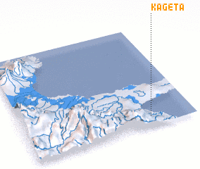 Places with similar names to Kageta, Papua New Guinea ::
Disclaimer :: Information on this page comes without warranty of any kind |
||
|
Where is Kageta? Elevation and coordinates ::
Latitude (lat): 9°54'0"S Longitude (lon): 149°45'0"E
Elevation (approx.): 71m (map arrows pan, magnifying glasses zoom) |
||
|
Visiting Kageta? Hotel/Accommodation ::
Book a hotel in Kageta Travel Guide ::
rental cars ::
car rental offers GPS waypoint ::
download a GPX waypoint (PoI) of Kageta for your GPS receiver
|
||