|
search place name
|
||
Kagu (Papua New Guinea)Kagu is a town in Papua New Guinea. An overview map of the region around Kagu is displayed below.
regional and 3d topo map of Kagu, Papua New Guinea ::

Kagu airports ::
The nearest airport is GKA - Goroka, located 32.4 km north west of Kagu.
Other airports nearby include MAG - Madang (125.1 km north), LAE - Nadzab (131.3 km east), HGU - Mount Hagen (150.7 km west), Nearby towns ::
Numiagufa (2.6km south west) //
Kafegoruga (2.6km north west) //
Yova (2.6km north west) //
Agomonofi (4.1km south east) //
Meihenavi (4.1km north east) //
Kofomuga (4.1km north west) //
Motuo (5.2km south east) //
Nenkefaro (5.2km south west) //
Negire (5.2km south west) //
Yoya (5.2km north west) //
Narenkafenofi (5.5km east) //
Baninofi (5.8km east) //
Hofakafenofi (5.8km east) //
Kerebabi (5.8km east) //
Keregera (5.9km south) //
Aninofi (5.8km west) //
Kiyo (6.7km south east) //
Iahotegabi (6.7km north east) //
Nonovei (6.7km south west) //
Hogoteru (6.7km south west) //
Abarabofi (7.6km east) //
Yago (7.6km south) //
Lampo (7.6km north) //
Numuga (7.8km south west) //
Kakopi (8.3km south east) //
Keka (8.2km north east) //
Ababe (8.2km north east) //
Motuo (9.2km south east) //
Unege (9.2km south west) //
[all distances 'as the bird flies' and approximate] 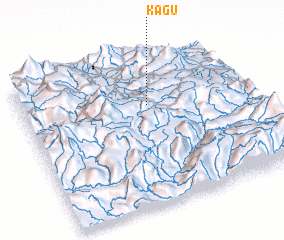 Places with similar names to Kagu, Papua New Guinea ::
Disclaimer :: Information on this page comes without warranty of any kind |
||
|
Where is Kagu? Elevation and coordinates ::
Latitude (lat): 6°19'0"S Longitude (lon): 145°34'0"E
Elevation (approx.): 1740m (map arrows pan, magnifying glasses zoom) |
||
|
Visiting Kagu? Hotel/Accommodation ::
Book a hotel in Kagu Travel Guide ::
rental cars ::
car rental offers GPS waypoint ::
download a GPX waypoint (PoI) of Kagu for your GPS receiver
|
||