|
search place name
|
||
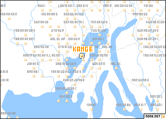
Kamge (Papua New Guinea)Kamge is a town in Papua New Guinea. An overview map of the region around Kamge is displayed below.
regional and 3d topo map of Kamge, Papua New Guinea ::
Kamge airports ::
The nearest airport is WWK - Wewak Intl, located 77.5 km east of Kamge.
Nearby towns ::
Yindigo (0.0km north) //
Maunda (1.9km north) //
Kusauga (1.9km south) //
Mul (1.8km east) //
Kunjingini (2.6km north east) //
Tuwaikim (2.6km north east) //
Kutigum (2.6km north west) //
Palgere (2.6km south east) //
Mikau (2.6km south west) //
Wegior (2.6km south east) //
Patigo (2.6km south east) //
Wombisa (2.6km south west) //
Waigamaga (3.7km north) //
Numamaka (3.7km north) //
Rubugum Villages (3.7km north) //
Balampta (3.7km north) //
Gwoiraru (3.7km north) //
Kunjingini (3.7km east) //
Tugaikum (3.7km west) //
Gulakim (3.7km west) //
Nainda (3.7km south) //
Magungu (3.7km south) //
Stapigum (4.1km north west) //
Abusit 1 (4.1km north east) //
Isogum (4.1km north west) //
Abusit 2 (4.1km north east) //
Kumunugum 2 (4.1km north west) //
Kaugiak (4.1km north east) //
Leongai (4.1km north east) //
[all distances 'as the bird flies' and approximate] 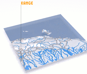 Places with similar names to Kamge, Papua New Guinea ::
Disclaimer :: Information on this page comes without warranty of any kind |
||
|
Where is Kamge? Elevation and coordinates ::
Latitude (lat): 3°47'0"S Longitude (lon): 143°0'0"E
Elevation (approx.): 71m (map arrows pan, magnifying glasses zoom) |
||
|
Visiting Kamge? Hotel/Accommodation ::
Book a hotel in Kamge Travel Guide ::
rental cars ::
car rental offers GPS waypoint ::
download a GPX waypoint (PoI) of Kamge for your GPS receiver
|
||