|
search place name
|
||
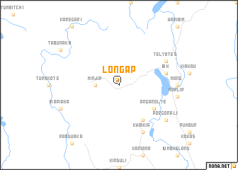
Longap (Papua New Guinea)Longap is a town in Papua New Guinea. An overview map of the region around Longap is displayed below.
regional and 3d topo map of Longap, Papua New Guinea ::
Longap airports ::
The nearest airport is HGU - Mount Hagen, located 101.8 km east of Longap.
Nearby towns ::
 Places with similar names to Longap, Papua New Guinea ::
// Long Apu (MY)
// Long Pa (MY)
// Lankupiai (LT)
// Lunca Apei (RO)
// Lengupa (CO)
// Longpi (IN)
// Langap (ID)
// Làng Ấp Py (LA)
// Ling-pao (TW)
// Lenkupie (PL)
Disclaimer :: Information on this page comes without warranty of any kind |
||
|
Where is Longap? Elevation and coordinates ::
Latitude (lat): 5°43'0"S Longitude (lon): 143°23'0"E
Elevation (approx.): 2585m (map arrows pan, magnifying glasses zoom) |
||
|
Visiting Longap? Hotel/Accommodation ::
Book a hotel in Longap Travel Guide ::
rental cars ::
car rental offers GPS waypoint ::
download a GPX waypoint (PoI) of Longap for your GPS receiver
|
||