|
search place name
|
||
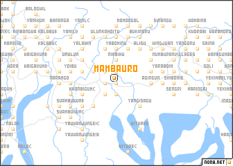
Mambauro (Papua New Guinea)Mambauro is a town in Papua New Guinea. An overview map of the region around Mambauro is displayed below.
regional and 3d topo map of Mambauro, Papua New Guinea ::
Mambauro airports ::
The nearest airport is WWK - Wewak Intl, located 53.7 km east of Mambauro.
Nearby towns ::
Gwinyingi (0.0km north) //
Wagupma (0.0km north) //
Balmo Villages (1.9km south) //
Bepandu (1.9km north) //
Kombenobo (1.8km west) //
Wingei 1 (1.8km west) //
Bugitu (1.8km west) //
Walangai (2.6km north west) //
Wingei 2 (2.6km south west) //
Suanumbo (2.6km north west) //
Gwalip 1 (2.6km north west) //
Gwalip 2 (2.6km north west) //
Nimbihu (3.7km north) //
Aunyalin Number 2 (4.1km north west) //
Bengaragum (5.2km south west) //
Witupe Hamlets (5.2km south east) //
Kamanjan (5.2km south east) //
Yangisagu (5.2km south east) //
Nambenogwen (5.6km north) //
Malapaiem (5.6km north) //
Yabominu (5.6km north) //
Boim 2 (5.5km east) //
Agingun (5.5km east) //
Yangasagu (5.8km west) //
Kwonbigum 2 (5.8km west) //
Kuragamon Villages (5.9km north) //
Ahiglium (5.9km north) //
Nambari 2 (5.8km east) //
Sagasi (6.7km south west) //
[all distances 'as the bird flies' and approximate] 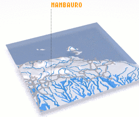 Places with similar names to Mambauro, Papua New Guinea ::
Disclaimer :: Information on this page comes without warranty of any kind |
||
|
Where is Mambauro? Elevation and coordinates ::
Latitude (lat): 3°42'0"S Longitude (lon): 143°12'0"E
Elevation (approx.): 143m (map arrows pan, magnifying glasses zoom) |
||
|
Visiting Mambauro? Hotel/Accommodation ::
Book a hotel in Mambauro Travel Guide ::
rental cars ::
car rental offers GPS waypoint ::
download a GPX waypoint (PoI) of Mambauro for your GPS receiver
|
||