|
search place name
|
||
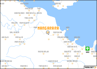
Mangarara (Papua New Guinea)Mangarara is a town in Papua New Guinea. An overview map of the region around Mangarara is displayed below.
regional and 3d topo map of Mangarara, Papua New Guinea ::
Mangarara airports ::
The nearest airport is WWK - Wewak Intl, located 16.1 km east of Mangarara.
Nearby towns ::
Suwambukau (1.9km south) //
Yarapos (1.8km east) //
Nunguma (3.7km east) //
Rambumba (4.1km north west) //
Rainimbo (4.1km north west) //
Wauntoki (5.9km east) //
Yauwosoru (5.9km east) //
Suaru (5.9km east) //
Wom (7.6km east) //
Nionganja (7.6km south) //
Minga (7.6km east) //
Gringrin Villages (7.9km north west) //
Wariman (8.3km south east) //
Parom Villages (9.3km north west) //
Yaulong (9.3km north west) //
Dwelamba (9.3km south east) //
Numbatui (10.5km north west) //
Sauri 1 (10.5km south east) //
[all distances 'as the bird flies' and approximate] 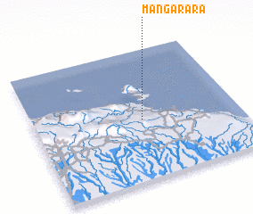 Places with similar names to Mangarara, Papua New Guinea ::
Disclaimer :: Information on this page comes without warranty of any kind |
||
|
Where is Mangarara? Elevation and coordinates ::
Latitude (lat): 3°32'0"S Longitude (lon): 143°32'0"E
Elevation (approx.): 23m (map arrows pan, magnifying glasses zoom) |
||
|
Visiting Mangarara? Hotel/Accommodation ::
Book a hotel in Mangarara Travel Guide ::
rental cars ::
car rental offers GPS waypoint ::
download a GPX waypoint (PoI) of Mangarara for your GPS receiver
|
||