|
search place name
|
||
Tabiribo (Papua New Guinea)Tabiribo is a town in Papua New Guinea. An overview map of the region around Tabiribo is displayed below.
regional and 3d topo map of Tabiribo, Papua New Guinea ::
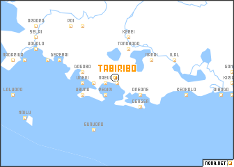
Nearby towns ::
Dabutu (0.0km north) //
Maeva (1.8km west) //
Pediri (2.6km south west) //
Borebo (3.6km west) //
One One (4.1km south east) //
Gea Gea (5.2km south east) //
Unevi (5.5km west) //
Dagobo (5.8km west) //
Tanobada (5.9km north) //
Ubuna (5.8km west) //
Mamai (6.6km north east) //
Kebei (7.6km north) //
Eunuoro (8.3km south west) //
[all distances 'as the bird flies' and approximate]  Places with similar names to Tabiribo, Papua New Guinea ::
// Dabburab (PH)
// Tebourba (TN)
// Tebrebe (GH)
// Dowbbā ‘Arab (IR)
// Deba Robī (ET)
// Debra Abbai (ET)
Disclaimer :: Information on this page comes without warranty of any kind |
||
|
Where is Tabiribo? Elevation and coordinates ::
Latitude (lat): 10°20'0"S Longitude (lon): 149°29'0"E
Elevation (approx.): -32768m (map arrows pan, magnifying glasses zoom) |
||
|
Visiting Tabiribo? Hotel/Accommodation ::
Book a hotel in Tabiribo Travel Guide ::
rental cars ::
car rental offers GPS waypoint ::
download a GPX waypoint (PoI) of Tabiribo for your GPS receiver
|
||