|
search place name
|
||
La Pita (Chinandega, Nicaragua)La Pita is a town in the Chinandega region of Nicaragua. An overview map of the region around La Pita is displayed below.
regional and 3d topo map of La Pita, Nicaragua ::

La Pita airports ::
The nearest airport is MGA - Managua Intl, located 131.5 km south east of La Pita.
Other airports nearby include TGU - Tegucigalpa Toncontin Intl (161.8 km north), SAL - San Salvador El Salvador Intl (213.6 km north west), Nearby towns ::
La Escuadra (1.9km north) //
Maderas Negras (1.9km south) //
San Miguel (2.6km south east) //
La Chilamita (2.6km north west) //
El Pozo (4.1km north east) //
Puerto Zapote (4.1km south west) //
El Fortín (5.8km north) //
Ceilán (5.7km east) //
El Bálsamo (5.7km east) //
Monte Cristo (5.8km north) //
Fátima (6.6km south east) //
Las Costillas (7.4km north) //
Paredones (7.8km south east) //
Santa Elena (7.8km north east) //
San Fernando (8.1km south east) //
San Jerónimo (9.1km north east) //
El Zanate (10.4km south east) //
La Estrella (10.4km north east) //
Gemastepe (10.4km north west) //
[all distances 'as the bird flies' and approximate] 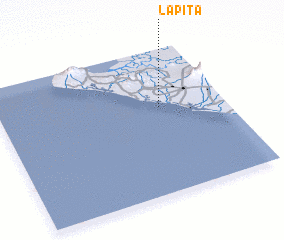 Places with similar names to La Pita, Nicaragua ::
Disclaimer :: Information on this page comes without warranty of any kind |
||
|
Where is La Pita? Elevation and coordinates ::
Latitude (lat): 12°36'0"N Longitude (lon): 87°17'0"W
Elevation (approx.): 9m (map arrows pan, magnifying glasses zoom) |
||
|
Visiting La Pita? Hotel/Accommodation ::
Book a hotel in La Pita Travel Guide ::
Buy a travel guide for Nicaragua rental cars ::
car rental offers GPS waypoint ::
download a GPX waypoint (PoI) of La Pita for your GPS receiver
|
||