|
search place name
|
||
Santa Teresa (Carazo, Nicaragua)Santa Teresa is a town in the Carazo region of Nicaragua. An overview map of the region around Santa Teresa is displayed below.
regional and 3d topo map of Santa Teresa, Nicaragua ::

Santa Teresa airports ::
The nearest airport is MGA - Managua Intl, located 37.8 km north of Santa Teresa.
Other airports nearby include LIR - Liberia Daniel Oduber Quiros Intl (149.8 km south east), NOB - Nosara Beach Nosara (209.4 km south), SJO - San Jose Juan Santamaria Intl (292.8 km south east), Nearby towns ::
Las Marías (0.0km north) //
Los Potrerillos (1.8km east) //
Güiquiliapa (2.6km north west) //
El Abra (2.6km south west) //
San Francisco de La Unión (2.6km south east) //
Los Cruces (2.6km north east) //
El Rosario (3.7km north) //
Panamá (3.6km west) //
Dulce Nombre (4.1km north west) //
Las Enramadas (4.1km south west) //
Nancite Dulce (4.1km south east) //
Santa Rita (4.1km south west) //
El Aguacate (4.1km north west) //
La Paz de Oriente (4.1km north east) //
La Piedra Pintada (5.2km south west) //
Comalcalpa (5.2km south east) //
San Francisco (5.6km south) //
El Ojochal (5.4km west) //
San José de Monte Redondo (5.8km north) //
El Cacao (5.8km south) //
Las Tablas (5.7km east) //
Jinotepe (6.6km north west) //
La Pita (6.6km south west) //
El Ingenio (7.5km west) //
Santa Isabel (7.6km north) //
Esquipulas (7.5km east) //
Las Crucitas (7.8km north east) //
Dolores (7.8km north west) //
El Panamá (8.1km south west) //
[all distances 'as the bird flies' and approximate] 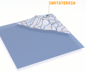 Places with similar names to Santa Teresa, Nicaragua ::
// Santa Teresa (BR)
// Santa Teresa (BR)
// Santa Teresa (BR)
// Santa Teresa (BR)
// Santa Teresa (BR)
// Santa Teresa (BR)
// Santa Teresa (BR)
// Santa Teresa (BR)
// Santa Teresa (BR)
// Santa Teresa (BR)
Disclaimer :: Information on this page comes without warranty of any kind |
||
|
Where is Santa Teresa? Elevation and coordinates ::
Latitude (lat): 11°48'0"N Longitude (lon): 86°10'0"W
Elevation (approx.): 384m (map arrows pan, magnifying glasses zoom) |
||
|
Visiting Santa Teresa? Hotel/Accommodation ::
Book a hotel in Santa Teresa Travel Guide ::
Buy a travel guide for Nicaragua rental cars ::
car rental offers GPS waypoint ::
download a GPX waypoint (PoI) of Santa Teresa for your GPS receiver
|
||