|
search place name
|
||
Banyaal (Bay, Somalia)Banyaal is a town in the Bay region of Somalia. An overview map of the region around Banyaal is displayed below.
regional and 3d topo map of Banyaal, Somalia ::

Nearby towns ::
Aw Reenow (0.0km north) //
Meykoofuurey (1.9km west) //
Idaadlow Mataakooy (1.9km west) //
Heer Aw Madow (1.9km west) //
Heer Caliyow Mamow (1.9km south) //
Hooday (2.6km south west) //
Gaal Guuris (2.6km south west) //
Heer Macalim (2.6km north west) //
Buur Dhijis (3.7km north) //
Hera Mata Gooy (3.7km north) //
Goof (3.7km north) //
Duura (3.7km south) //
Shuun Qaayle (3.7km west) //
Fulaayka (3.7km west) //
Haaf (4.1km north west) //
Heer Isaaq (4.1km south east) //
Heer Faqi (4.1km south east) //
Korey (4.1km south west) //
Shabeelle (4.1km south west) //
Galool Dheere (4.1km south east) //
Madow Burre (4.1km north east) //
Laambuul (5.2km north west) //
Guudka (5.2km south west) //
Biyooley (5.6km east) //
Aw Kuulaw (5.6km south) //
Buur Dhijis (5.9km north) //
Qaranka (5.9km south) //
Kuunyo (5.9km east) //
Wartaa (5.9km south) //
[all distances 'as the bird flies' and approximate] 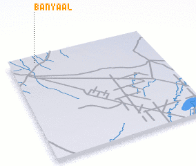 Places with similar names to Banyaal, Somalia ::
// Ban Yai La (TH)
// Ban Yai Liu (TH)
// Ban Yai Liu (TH)
// Ban Ya Le (TH)
// Bonyolo (BF)
// Banayale (CD)
// Bannayili (GH)
// Binayili (GH)
// Bunyolo (UG)
// Ban Yalô (LA)
Disclaimer :: Information on this page comes without warranty of any kind |
||
|
Where is Banyaal? Elevation and coordinates ::
Latitude (lat): 2°57'0"N Longitude (lon): 44°11'0"E
Elevation (approx.): 229m (map arrows pan, magnifying glasses zoom) |
||
|
Visiting Banyaal? Hotel/Accommodation ::
Book a hotel in Banyaal Travel Guide ::
Buy a travel guide for Somalia rental cars ::
car rental offers GPS waypoint ::
download a GPX waypoint (PoI) of Banyaal for your GPS receiver
|
||