|
search place name
|
||
Duhurboode (Shabeellaha Hoose, Somalia)Duhurboode is a town in the Shabeellaha Hoose region of Somalia. An overview map of the region around Duhurboode is displayed below.
regional and 3d topo map of Duhurboode, Somalia ::
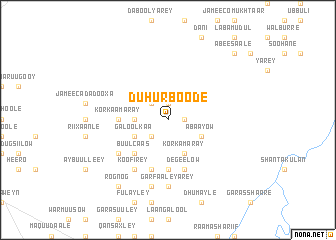
Nearby towns ::
Abbaayow (1.9km east) //
Orraxley (1.9km north) //
Luggod (2.6km north west) //
Cadey Barwaaqo (2.6km south west) //
Busley (2.6km south west) //
Lugqod (2.6km south west) //
Godobey (3.7km west) //
Bannaaney (3.7km west) //
Duhur Boob (4.1km south east) //
Korka Maray (4.1km south east) //
Abaayow (4.1km south east) //
Galoolkaa (4.1km south west) //
Buulcaas (5.2km south west) //
Korkaamaray (5.6km west) //
Deg Biti (5.6km south) //
Cadey Barwaaqo (5.6km south) //
Degeelow (5.9km south) //
Balcad (5.9km south) //
Banaanag (6.7km south west) //
Koofirey (6.7km south west) //
Danakuus (7.4km south) //
Garfaale Yarey (7.4km south) //
Daba Galay (7.4km south) //
Garfaale Weyne (7.6km south) //
Rognog (9.3km south west) //
Washaaqo (10.5km north east) //
Abeesaale (10.5km north east) //
[all distances 'as the bird flies' and approximate] 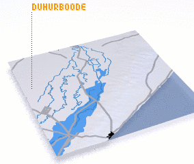 Places with similar names to Duhurboode, Somalia ::
Disclaimer :: Information on this page comes without warranty of any kind |
||
|
Where is Duhurboode? Elevation and coordinates ::
Latitude (lat): 2°42'0"N Longitude (lon): 45°4'0"E
Elevation (approx.): 96m (map arrows pan, magnifying glasses zoom) |
||
|
Visiting Duhurboode? Hotel/Accommodation ::
Book a hotel in Duhurboode Travel Guide ::
Buy a travel guide for Somalia rental cars ::
car rental offers GPS waypoint ::
download a GPX waypoint (PoI) of Duhurboode for your GPS receiver
|
||