|
search place name
|
||
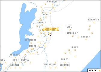
Jamaame (Jubbada Hoose, Somalia)Jamaame is a town in the Jubbada Hoose region of Somalia. An overview map of the region around Jamaame is displayed below.
regional and 3d topo map of Jamaame, Somalia ::
Jamaame airports ::
The nearest airport is KMU - Kismayu Kisimayu, located 59.4 km south west of Jamaame.
Nearby towns ::
Barwaaqo Weyn (1.2km south west) //
Aboro (2.0km west) //
Bugeey (2.3km north west) //
Balad Raxman (3.5km west) //
Bangeeni (3.6km south west) //
Madhaamey (4.0km west) //
Dhaay Garas (4.3km south west) //
Bambila (4.5km south west) //
Cusmaan Moto (4.5km south west) //
Mana Moofi (4.5km north west) //
Garas (4.5km west) //
Raaxole (5.1km north west) //
Howlwadaag (5.2km south west) //
Kobon (5.5km south west) //
Maama Sundha (6.2km north west) //
Fikiro (6.9km north west) //
Fagan (7.1km north west) //
Jiinis (7.2km north) //
Gaal (7.6km east) //
Kor Kaamar (7.7km west) //
Booriini (7.8km north west) //
Singibaar (7.9km south west) //
Araara (8.1km south west) //
Kabxanley (8.2km east) //
Xonqorre (8.4km south east) //
Muudey Qalaf (8.5km south west) //
Billaq (8.6km south east) //
Mukey Gaamila (8.6km north) //
Gamaanya (8.9km north) //
[all distances 'as the bird flies' and approximate] 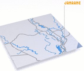 Places with similar names to Jamaame, Somalia ::
Disclaimer :: Information on this page comes without warranty of any kind |
||
|
Where is Jamaame? Elevation and coordinates ::
Latitude (lat): 0°4'20"S Longitude (lon): 42°45'2"E
Elevation (approx.): 11m (map arrows pan, magnifying glasses zoom) |
||
|
Visiting Jamaame? Hotel/Accommodation ::
Book a hotel in Jamaame Travel Guide ::
Buy a travel guide for Somalia rental cars ::
car rental offers GPS waypoint ::
download a GPX waypoint (PoI) of Jamaame for your GPS receiver
|
||