|
search place name
|
||
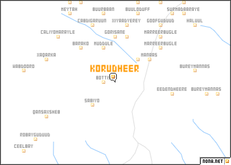
Korudheer (Bay, Somalia)Korudheer is a town in the Bay region of Somalia. An overview map of the region around Korudheer is displayed below.
regional and 3d topo map of Korudheer, Somalia ::
Nearby towns ::
Bottis (1.9km west) //
Busley (5.2km north east) //
Sabiyo (5.2km south west) //
Muddule (5.9km north) //
Manaas (6.7km north east) //
Gorisane (7.4km north) //
Cadei Barrey (7.6km north) //
Barako (7.9km north west) //
Marreer Bugle (9.3km north east) //
Marreer Bugle (10.5km north east) //
[all distances 'as the bird flies' and approximate]  Places with similar names to Korudheer, Somalia ::
// Garðar (IS)
// Garður (IS)
// Kiritehere (NZ)
// Gārdhari (IN)
// Gārdhari (IN)
// Gārdher (IN)
// Gariadhar (IN)
// Kūrdhār (IN)
// Gairi Dhara (PK)
// Qoridheere (SO)
Disclaimer :: Information on this page comes without warranty of any kind |
||
|
Where is Korudheer? Elevation and coordinates ::
Latitude (lat): 2°52'0"N Longitude (lon): 43°25'0"E
Elevation (approx.): 464m (map arrows pan, magnifying glasses zoom) |
||
|
Visiting Korudheer? Hotel/Accommodation ::
Book a hotel in Korudheer Travel Guide ::
Buy a travel guide for Somalia rental cars ::
car rental offers GPS waypoint ::
download a GPX waypoint (PoI) of Korudheer for your GPS receiver
|
||