|
search place name
|
||
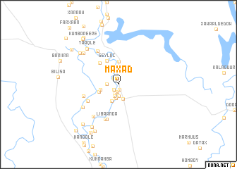
Maxad (Jubbada Dhexe, Somalia)Maxad is a town in the Jubbada Dhexe region of Somalia. An overview map of the region around Maxad is displayed below.
regional and 3d topo map of Maxad, Somalia ::
Maxad airports ::
The nearest airport is KMU - Kismayu Kisimayu, located 104.6 km south of Maxad.
Nearby towns ::
Maanyagaabo (0.8km south) //
Muuna (1.1km south west) //
Fanoole No. 2 (1.2km south) //
Limoole (1.2km north west) //
Misra (1.5km south) //
Labadaad (1.9km south) //
Cabdalle Kakane (1.9km west) //
Xatal Baraka (2.0km south) //
Baladu Raxma (2.2km south) //
Jilib (2.4km south) //
Kablaandi (2.8km south) //
Cusbooley (2.9km north west) //
Gajawa (2.9km north) //
Mobileyn (3.0km west) //
Geedgoy (3.3km west) //
Madhooka (3.7km north) //
Seylac (4.1km north west) //
Makuungo (4.1km north west) //
Galiyo Guubow (4.1km north west) //
Baladul Kariim (4.5km north west) //
Shidaad (5.5km south west) //
Amiiney (5.9km south) //
Libaanga (5.9km south) //
Makanyaaga (5.9km west) //
Qalaaliyow (5.9km south) //
Mashemba (6.2km north west) //
Barwaaqo (6.4km south west) //
Makuuni (6.7km south west) //
Mansuura Yar (7.5km north west) //
[all distances 'as the bird flies' and approximate] 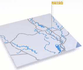 Places with similar names to Maxad, Somalia ::
Disclaimer :: Information on this page comes without warranty of any kind |
||
|
Where is Maxad? Elevation and coordinates ::
Latitude (lat): 0°31'0"S Longitude (lon): 42°46'0"E
Elevation (approx.): 25m (map arrows pan, magnifying glasses zoom) |
||
|
Visiting Maxad? Hotel/Accommodation ::
Book a hotel in Maxad Travel Guide ::
Buy a travel guide for Somalia rental cars ::
car rental offers GPS waypoint ::
download a GPX waypoint (PoI) of Maxad for your GPS receiver
|
||