|
search place name
|
||
Maxamuudow (Bay, Somalia)Maxamuudow is a town in the Bay region of Somalia. An overview map of the region around Maxamuudow is displayed below.
regional and 3d topo map of Maxamuudow, Somalia ::
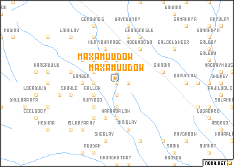
Nearby towns ::
War Isho (0.0km north) //
Gol (1.9km north) //
Kaaysiney (1.9km south) //
Jemeecada (1.9km east) //
Maxamuudow (2.6km north west) //
Gal Madowle (3.7km west) //
Low Buulo (3.7km north) //
Kaaysiney (3.7km south) //
Baanyaale (4.1km north west) //
Gallow (4.1km south west) //
Barkhadlow (4.1km south west) //
Baanyale Mubaarak (4.1km north west) //
Baanyale Banka (5.2km north west) //
Kunyogo (5.2km south west) //
Gaal Looge (5.6km west) //
Gamber (5.6km west) //
Waraabalow (5.6km south) //
Kuniyo Warabe (5.9km north) //
Caliyow Dooyo (5.9km south) //
Maroodmadi (6.7km north west) //
Caashe (6.7km south west) //
Mood Mooda (6.7km north east) //
Dhamaji (7.6km north) //
Waaboole (7.6km west) //
Shinbir (7.6km east) //
Koonya Gaduud (7.6km west) //
Showle (7.6km west) //
Miriqlay (7.6km south) //
Baanyale Goot Galoole (8.3km north west) //
[all distances 'as the bird flies' and approximate] 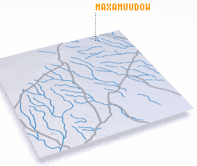 Places with similar names to Maxamuudow, Somalia ::
// Maxamuudow (SO)
Disclaimer :: Information on this page comes without warranty of any kind |
||
|
Where is Maxamuudow? Elevation and coordinates ::
Latitude (lat): 2°58'0"N Longitude (lon): 43°48'0"E
Elevation (approx.): 280m (map arrows pan, magnifying glasses zoom) |
||
|
Visiting Maxamuudow? Hotel/Accommodation ::
Book a hotel in Maxamuudow Travel Guide ::
Buy a travel guide for Somalia rental cars ::
car rental offers GPS waypoint ::
download a GPX waypoint (PoI) of Maxamuudow for your GPS receiver
|
||