|
search place name
|
||
Mundul (Hiiraan, Somalia)Mundul is a town in the Hiiraan region of Somalia. An overview map of the region around Mundul is displayed below.
regional and 3d topo map of Mundul, Somalia ::
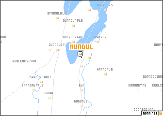
Nearby towns ::
Afgooye Cadde (1.9km east) //
Bukuraale (1.9km south) //
Kulan Xagay (4.1km north west) //
Hillo Aw Mahad (5.2km north east) //
Quracley (5.9km west) //
Haan Gale (6.7km south east) //
Eji (7.4km south) //
Haro-Lugoole (7.6km west) //
Qurac Jafle (7.6km north) //
[all distances 'as the bird flies' and approximate] 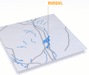 Places with similar names to Mundul, Somalia ::
Disclaimer :: Information on this page comes without warranty of any kind |
||
|
Where is Mundul? Elevation and coordinates ::
Latitude (lat): 3°15'0"N Longitude (lon): 45°32'0"E
Elevation (approx.): 123m (map arrows pan, magnifying glasses zoom) |
||
|
Visiting Mundul? Hotel/Accommodation ::
Book a hotel in Mundul Travel Guide ::
Buy a travel guide for Somalia rental cars ::
car rental offers GPS waypoint ::
download a GPX waypoint (PoI) of Mundul for your GPS receiver
|
||