|
search place name
|
||
Tuugar (Bay, Somalia)Tuugar is a town in the Bay region of Somalia. An overview map of the region around Tuugar is displayed below.
regional and 3d topo map of Tuugar, Somalia ::
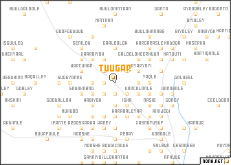
Nearby towns ::
War Hawen (1.9km west) //
Intee Ka Kadiidaa (1.9km south) //
Awlo (1.9km south) //
Isgagoonaweyn (2.6km south west) //
Boolmadu (2.6km north west) //
Gubadi (2.6km south east) //
Gof Caddey (2.6km south east) //
Asha Farfow (2.6km north east) //
Caliyow Eene (3.7km west) //
Diiqow (3.7km south) //
Buulohilowle (3.7km east) //
Gaalsomale (3.7km east) //
Hawanley (4.1km south west) //
Gurinlow (4.1km north west) //
Golmallab (4.1km north west) //
Isha (4.1km south east) //
War Calanle (4.1km south east) //
Garmagal (4.1km north east) //
Waryaryoyi (4.1km north east) //
Xaarbiyow (5.2km north west) //
Wabiyow (5.2km south west) //
Galoolo Heer Huun (5.2km north east) //
Galamo (5.2km north east) //
Warabale Weyn (5.6km south) //
Gaaloolow (5.6km north) //
Yaqle (5.6km east) //
Gaal Somaal (5.6km east) //
War Cumar (5.9km west) //
Sada Kabad (5.9km west) //
[all distances 'as the bird flies' and approximate] 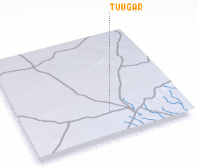 Places with similar names to Tuugar, Somalia ::
Disclaimer :: Information on this page comes without warranty of any kind |
||
|
Where is Tuugar? Elevation and coordinates ::
Latitude (lat): 3°15'0"N Longitude (lon): 43°33'0"E
Elevation (approx.): 495m (map arrows pan, magnifying glasses zoom) |
||
|
Visiting Tuugar? Hotel/Accommodation ::
Book a hotel in Tuugar Travel Guide ::
Buy a travel guide for Somalia rental cars ::
car rental offers GPS waypoint ::
download a GPX waypoint (PoI) of Tuugar for your GPS receiver
|
||