|
search place name
|
||
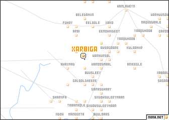
Xarbiga (Shabeellaha Hoose, Somalia)Xarbiga is a town in the Shabeellaha Hoose region of Somalia. An overview map of the region around Xarbiga is displayed below.
regional and 3d topo map of Xarbiga, Somalia ::
Nearby towns ::
Bi Bidhooy (1.9km south) //
Tulida (2.6km north west) //
War Mursal (3.7km east) //
Aw Cariif (4.1km south east) //
Waroos Maal (4.1km south east) //
Buusleey (4.1km south east) //
Aw Axmad (4.1km south west) //
Heer Aw Shiikh Abikar (5.2km north east) //
Galool Dheere (5.6km south) //
Buur Dheere (5.6km east) //
Galbooy (5.9km south) //
Aw Sagaare (5.9km east) //
Arbi (5.9km north) //
Cajuusa (6.7km south east) //
Baabash (6.7km south west) //
Ceel Qaraare (7.6km east) //
Eeloole (7.6km north) //
Dudumaay (7.6km north) //
Eenow Mideey (7.9km north east) //
Dawanle (8.3km north east) //
Fuhay (8.3km north west) //
Garas Dhaay (8.3km south east) //
Xako (9.3km north east) //
[all distances 'as the bird flies' and approximate] 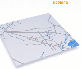 Places with similar names to Xarbiga, Somalia ::
Disclaimer :: Information on this page comes without warranty of any kind |
||
|
Where is Xarbiga? Elevation and coordinates ::
Latitude (lat): 2°31'0"N Longitude (lon): 44°49'0"E
Elevation (approx.): 89m (map arrows pan, magnifying glasses zoom) |
||
|
Visiting Xarbiga? Hotel/Accommodation ::
Book a hotel in Xarbiga Travel Guide ::
Buy a travel guide for Somalia rental cars ::
car rental offers GPS waypoint ::
download a GPX waypoint (PoI) of Xarbiga for your GPS receiver
|
||