|
search place name
|
||
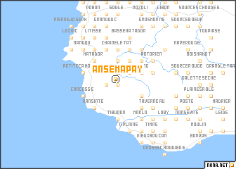
Anse Mapay (GrandʼAnse, Haiti)Anse Mapay is a town in the GrandʼAnse region of Haiti. An overview map of the region around Anse Mapay is displayed below.
regional and 3d topo map of Anse Mapay, Haiti ::
Anse Mapay airports ::
The nearest airport is GAO - Guantanamo Mariana Grajales, located 204.6 km north west of Anse Mapay.
Other airports nearby include BCA - Baracoa Playa Gustavo Rizo (219.7 km north), SCU - Santiago De Cuba Antonio Maceo Intl (231.6 km north west), Nearby towns ::
Vité (0.0km north) //
Ti lʼÉtang (0.0km north) //
Bazarin (1.8km west) //
Tenté (1.9km north) //
Grand Chemin (2.6km north east) //
Fond Jogue (3.7km north) //
Chaine Grande Bois (4.0km south east) //
Doco (4.0km north east) //
LʼÉtang (4.0km north east) //
Fond Mentin (4.1km north east) //
Nansinte (5.1km south west) //
Morne à Brûler (5.1km south east) //
Larousse (5.1km south east) //
Matador (5.1km north west) //
Douter (5.1km north west) //
Dumoulin (5.1km north east) //
Gauthier (5.6km north) //
Tiburon (5.6km south) //
Chaîne lʼÉtat (5.6km north) //
Carcasse (5.6km west) //
Petite Cahouane (5.6km west) //
Dupont (5.8km north) //
Bananier (5.8km north) //
Les Irois (5.6km west) //
Jogue (5.8km north) //
Béansine (5.8km north) //
Doute (5.8km north) //
Poisson (5.8km north) //
Caille (5.6km east) //
[all distances 'as the bird flies' and approximate] 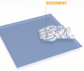 Places with similar names to Anse Mapay, Haiti :: Disclaimer :: Information on this page comes without warranty of any kind |
||
|
Where is Anse Mapay? Elevation and coordinates ::
Latitude (lat): 18°23'0"N Longitude (lon): 74°24'0"W
Elevation (approx.): 393m (map arrows pan, magnifying glasses zoom) |
||
|
Visiting Anse Mapay? Hotel/Accommodation ::
Book a hotel in Anse Mapay Travel Guide ::
Buy a travel guide for Haiti rental cars ::
car rental offers GPS waypoint ::
download a GPX waypoint (PoI) of Anse Mapay for your GPS receiver
|
||