|
search place name
|
||
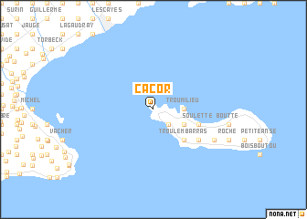
Cacor (Sud, Haiti)Cacor is a town in the Sud region of Haiti. An overview map of the region around Cacor is displayed below.
regional and 3d topo map of Cacor, Haiti ::
Cacor airports ::
The nearest airport is PAP - Port-au-prince Toussaint Louverture Intl, located 158.0 km east of Cacor.
Other airports nearby include CAP - Cap Haitien Intl (240.4 km north east), GAO - Guantanamo Mariana Grajales (268.0 km north west), Nearby towns ::
La Hatte (2.6km south east) //
Trou Milieu (3.5km east) //
Gros Morne (4.0km south east) //
Madame Bernard (4.0km south east) //
Trou lʼEmbarras (5.1km south east) //
Ca Coq (5.1km south east) //
Grand Sable (5.6km east) //
Pradel (5.6km east) //
Soulette (5.6km east) //
Figuler (6.5km south east) //
Bernard (6.5km south east) //
Grande Plaine (6.5km south east) //
Grande Barrière (8.0km south east) //
Boucan (8.0km south east) //
[all distances 'as the bird flies' and approximate] 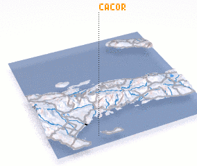 Places with similar names to Cacor, Haiti ::
Disclaimer :: Information on this page comes without warranty of any kind |
||
|
Where is Cacor? Elevation and coordinates ::
Latitude (lat): 18°6'0"N Longitude (lon): 73°42'0"W
Elevation (approx.): 40m (map arrows pan, magnifying glasses zoom) |
||
|
Visiting Cacor? Hotel/Accommodation ::
Book a hotel in Cacor Travel Guide ::
Buy a travel guide for Haiti rental cars ::
car rental offers GPS waypoint ::
download a GPX waypoint (PoI) of Cacor for your GPS receiver
|
||