|
search place name
|
||
Chic Kata (Ouest, Haiti)Chic Kata is a town in the Ouest region of Haiti. An overview map of the region around Chic Kata is displayed below.
regional and 3d topo map of Chic Kata, Haiti ::

Chic Kata airports ::
The nearest airport is PAP - Port-au-prince Toussaint Louverture Intl, located 86.9 km east of Chic Kata.
Other airports nearby include CAP - Cap Haitien Intl (139.3 km north east), BRX - Barahona Maria Montez Intl (216.0 km east), BCA - Baracoa Playa Gustavo Rizo (228.7 km north west), MOA - Moa Orestes Acosta (281.6 km north west), Nearby towns ::
Trou des Hommes (1.8km east) //
Mahotière (1.8km east) //
Platon Trou Bigaille (1.9km north) //
Barrière Battant (2.6km north east) //
Fleurant (2.6km north east) //
Pointe à Raquettes (2.6km south east) //
Terre Sèche (3.7km north) //
Nan Marc (3.7km north) //
Nan Calebasse (4.1km north west) //
Nan Plaine (4.1km north west) //
Bouzillette (4.0km north east) //
Madame Legros (4.0km north east) //
Source Philippe (4.0km north west) //
Bois Verna (5.1km south east) //
Gros Citerne (5.1km north west) //
Calmadère (5.8km north) //
LʼÉternel (5.8km north) //
Gros Morne (5.8km north) //
Trou Cochon (5.6km west) //
Ti Palmiste (5.6km east) //
Ti Palmiste (6.4km north east) //
Nan Plaine (6.6km north west) //
Bois Pin (7.0km east) //
Plaisance (7.0km east) //
Dielgo (7.0km east) //
Terre Rouge (7.0km east) //
Bousinette (7.4km north) //
Terre Sèche (7.4km north) //
Mouri Corps (7.3km east) //
[all distances 'as the bird flies' and approximate] 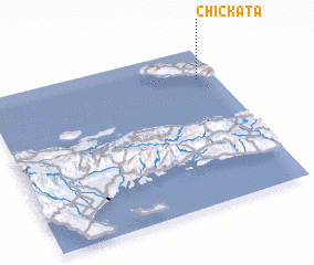 Places with similar names to Chic Kata, Haiti ::
Disclaimer :: Information on this page comes without warranty of any kind |
||
|
Where is Chic Kata? Elevation and coordinates ::
Latitude (lat): 18°48'0"N Longitude (lon): 73°5'0"W
Elevation (approx.): 16m (map arrows pan, magnifying glasses zoom) |
||
|
Visiting Chic Kata? Hotel/Accommodation ::
Book a hotel in Chic Kata Travel Guide ::
Buy a travel guide for Haiti rental cars ::
car rental offers GPS waypoint ::
download a GPX waypoint (PoI) of Chic Kata for your GPS receiver
|
||